Hiking
Whympr
23
June
2026
Explore 30 Trail Routes in Chamonix & Mont-Blanc
Ski touring
Ski
03
March
Discover 80 backcountry skiing routes around Chamonix with the Vamos guidebook.
February
Find all avalanche reports pretty anywhere in the world with Whympr.
20
Whympr centralizes key avalanche risk data to help you plan your mountain outings safely. Learn more in this article.
Climbing
26
January
Are you wondering if the Whympr mobile app is free? This is what we will see in this article.
22
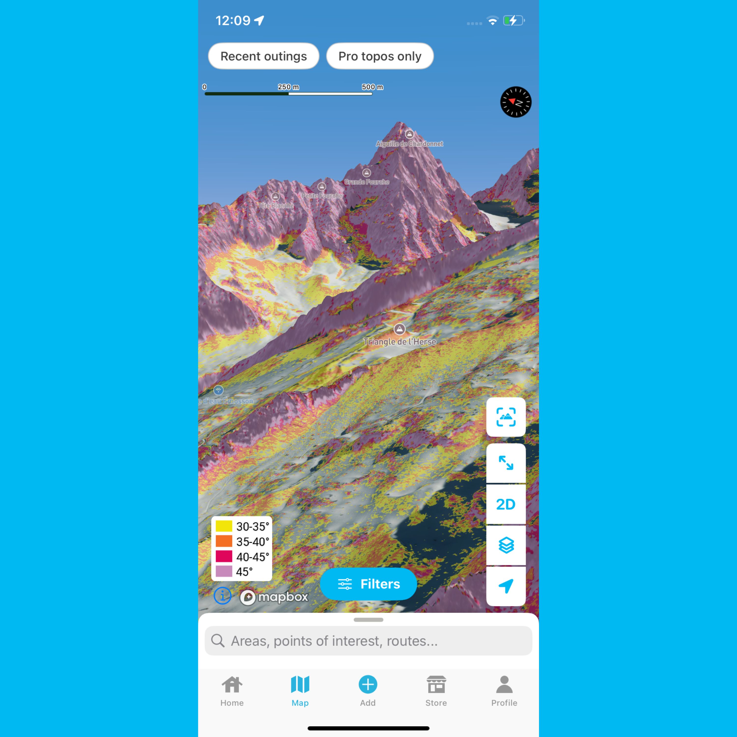
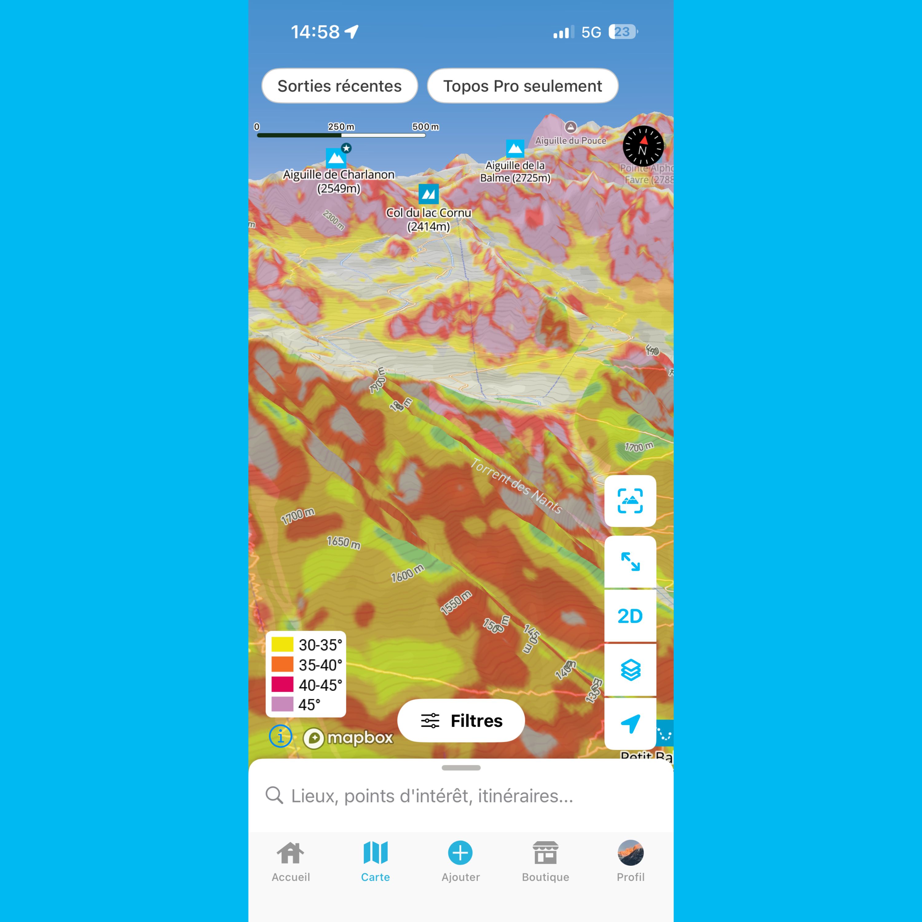
What is a slope gradient layer? Why is it important for planning your mountain trips? How do you read it correctly? We cover everything you need to know in this article.
12
Check out the resolution of Whympr’s world slope gradient layer legend in this article.
07
This article helps you understand slope gradient layers in Whympr
06
FATMAP has shut down on October 1st 2024. Which mountain app should you choose to prepare for your outdoor outings?
04
December
2025
Take your outdoor adventures to the next level this winter with our brand-new winter map featuring 3D LiDAR.
Tutorial
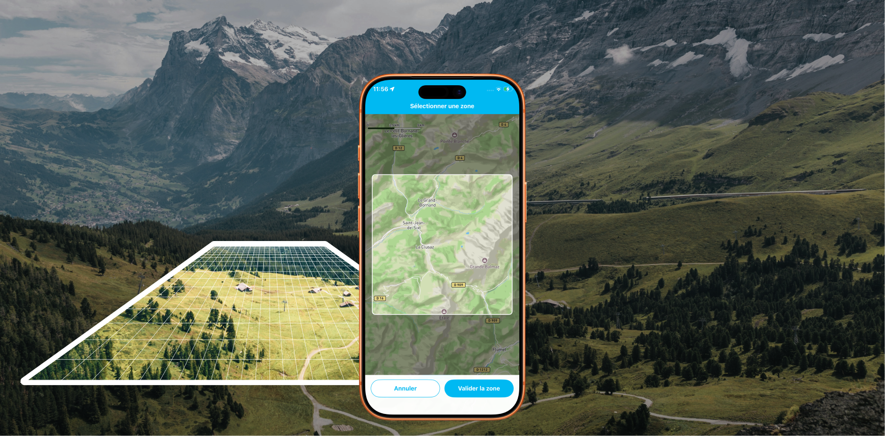
Offline Maps: Download areas from anywhere on Earth and travel without a data connection with Whympr
Alpinism
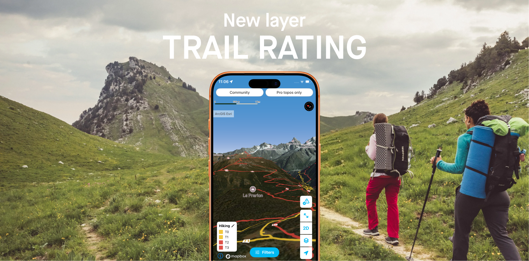
Whympr introduces 2 new layers to display the difficulty ratings of all hiking trails around the world.
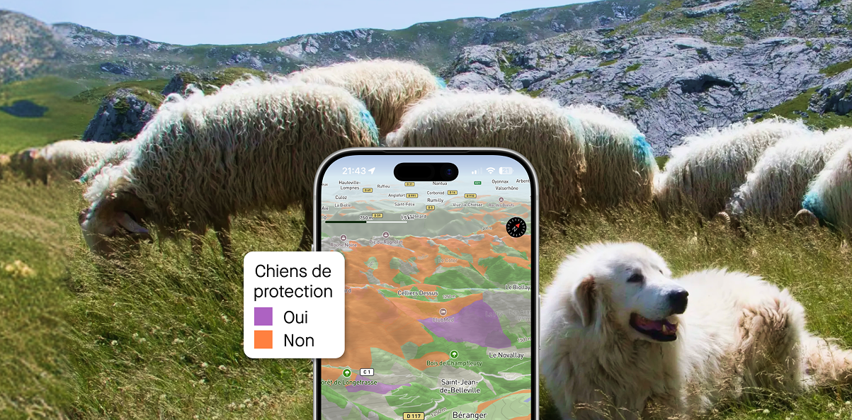
Plan your hikes with peace of mind this summer in France and Switzerland with the new “guard dog zone” overlays
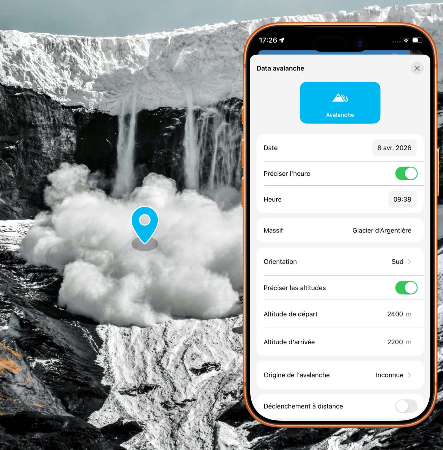
Alert the community and report avalanches quickly with just a few taps in the app
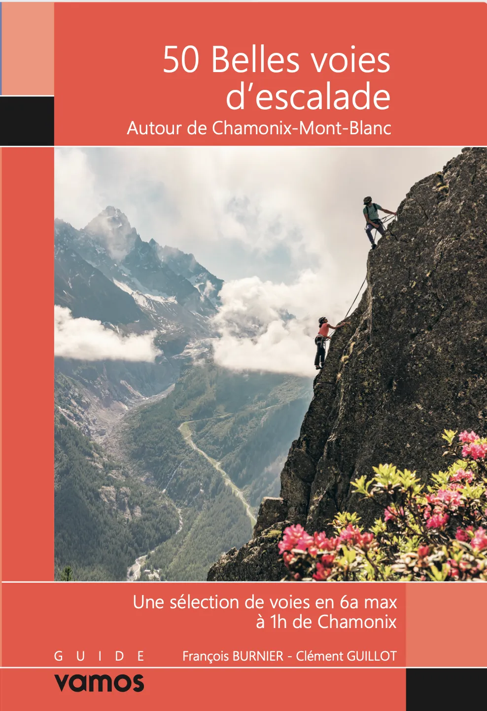
New: 50 beautiful climbing routes to discover around Chamonix.