Discover the Mont Blanc massif on foot
Want to explore the Mont Blanc massif on foot? The Mont-Blanc Hikes book by Vamos publishing is made for you! Nothing beats hiking to take in the landscapes, observe wildlife and flora, and enjoy a great picnic!
Whether you’re looking for a gentle walk with little elevation gain or a big mountain adventure to really get moving, you’ll find a great selection of routes in the Vamos guidebook.
You’ll discover the Mont Blanc massif—but not only that! Of course, you’ll find all the hikes around Chamonix, Les Contamines, and the Swiss and Italian sides, but you’ll also get ideas for walking in the Fiz range, the Aravis, or even Sex Carro.
In both French and English, with descriptions, maps, photos, and GPX tracks, you’ll have everything you need for a perfect day out!
The Vamos topo guide: everything you need for hiking around Mont Blanc!
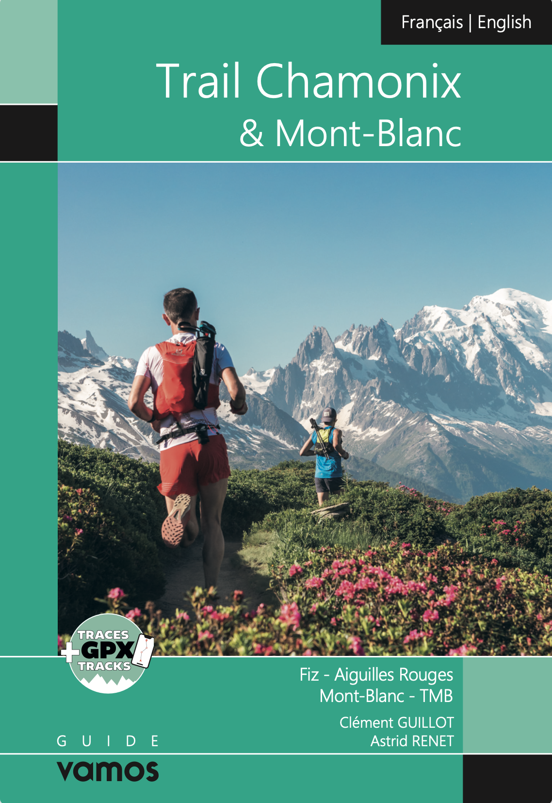
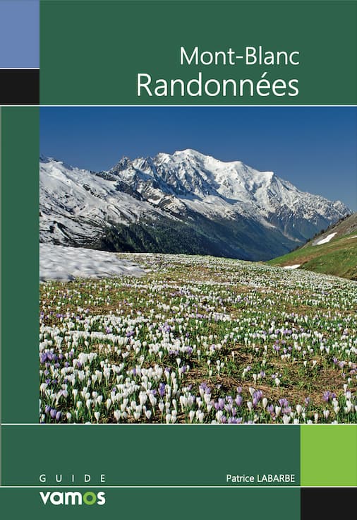
The Mont Blanc massif isn’t just a playground for mountaineers and skiers. It’s also home to trails loved by hikers from all over the world. You may already know the famous Tour du Mont Blanc, which takes several days to complete. But this massif is also a paradise for day hikes. From steep terrain shared with chamois to gentler routes ending at a mountain café, you’ll find it all in Mont-Blanc Hikes from Vamos publishing. Updated in 2023, all information has been checked and is fully up to date.
You can buy it directly from the Vamos publishing website for €25.
Don’t hesitate to venture beyond the Chamonix area to explore the Fiz massif or wander through the Aravis.
You’ll find 100 hiking routes across 8 areas: Chamonix (Mont Blanc massif and Aiguilles Rouges), Vallorcine, the Italian and Swiss slopes of the Mont Blanc massif, Les Contamines, the Anterne sector in the Fiz, the Aravis, and Sex Carro.
At the beginning of the book, you’ll find an overview of the hiking difficulty ratings (R1, R2 up to R4), as well as a list of useful phone numbers for each area.
For each route description, you’ll find:
- Positive and negative elevation gain
- Starting and ending altitude
- Duration
- Difficulty rating
- Whether dogs are allowed or not
- Whether cable cars can be used or not
- IGN map references
- Photos
- A map with the hiking route
- A detailed description of the itinerary and practical tips
You can trust Patrice Labarbe. The author of this book, as well as a mountain guide and photographer, he knows the most beautiful spots in the massif by heart.

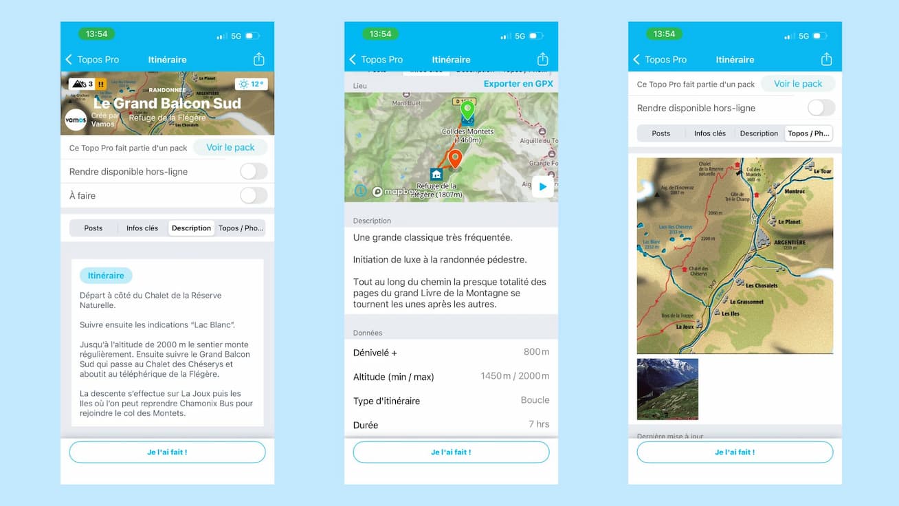
Digital hiking : Topos Pro Vamos in your phone
These topo guides, and many others available in the app, are called Topos Pro.
First of all, what is a Topo Pro? It’s a topo written by professionals, with high-quality information, available for purchase in the Whympr app (individually or as a bundle).
You can find the Mont-Blanc Hikes book with its 100 routes as a bundle, but you can also buy routes individually or by sector, for example the Argentière basin area. As with printed topo books, a percentage is paid back to the authors.
The digital format offers many advantages: for hiking Topos Pro, but also snowshoeing, ski touring, or mountaineering, you also get access to GPX tracks of the routes.
You can easily find the exact topo you’re interested in, locate it on the map, and always have it with you in the mountains… With the Whympr Premium version, you also get additional useful features for your Topos Pro, such as offline access, weather display, mapping the route on IGN maps, or recording, sharing your GPX track, locating where patous are, and many other tools.
The Vamos publishing house is part of the same company as Whympr. The idea is to combine print and digital, which we see as complementary. That’s why when you buy a Vamos topo book, you also get its digital version for free in Whympr!
If you want to know more about Topos Pro, I invite you to read our blog article on the subject, where you’ll also find the list of Topos Pro available in Whympr. You can also watch our tutorial on YouTube.
Hiking in the Calanques or the Destel gorges, climbing in Chamonix, and more—you’re sure to find something you love. Combine the pleasure of browsing the book at home to search and compare routes before you go, then find everything on your phone once you’re in the mountains.
The Whympr app, your hiking ally
These Topos Pro are available exclusively in Whympr, making it the perfect opportunity to discover all the app’s features designed for hiking.
Most of these features are included with the Whympr Premium subscription (€24.99 per year). Feel free to try it out, as you get a one-week free trial to decide.
Among the many tools in the app for hiking, ski touring, climbing, and mountaineering, here’s a selection of features that might interest you:
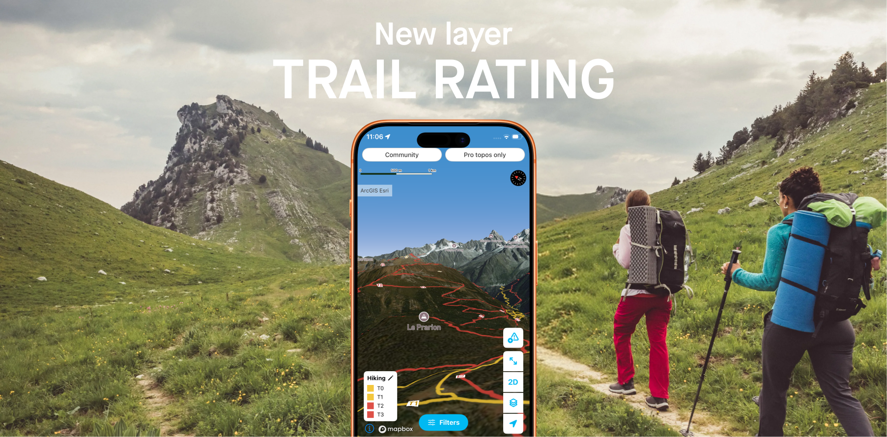
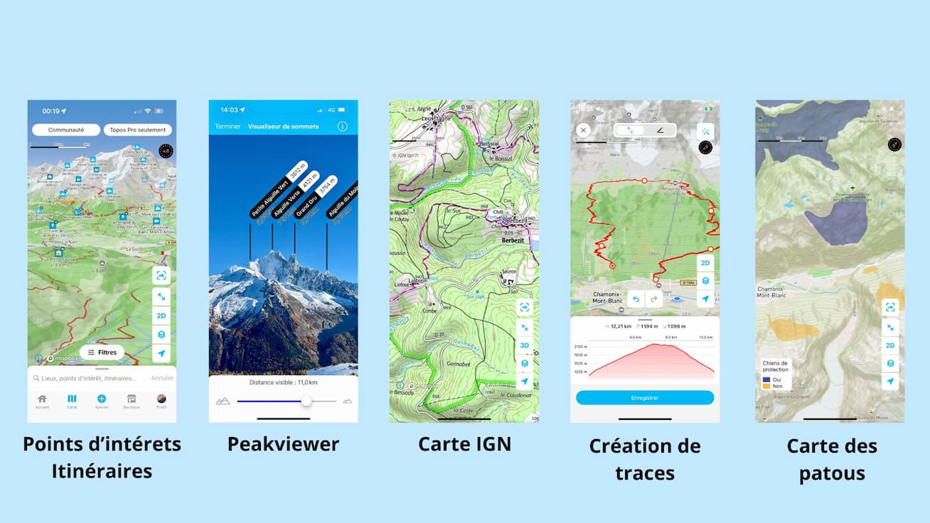
- Mapping: worldwide map layers such as IGN, Swisstopo, or Italian maps. You can view them in 3D and add overlays (slope angle and orientation, flat areas for bivouacs, wildlife-sensitive zones, etc.).
- Track features (create, record, offline use, etc.).
- 100,000 points of interest and routes worldwide + hiking tracks across France and Switzerland
- Offline routes and maps
- Peak View to visualize summits
- 28,000 webcams worldwide
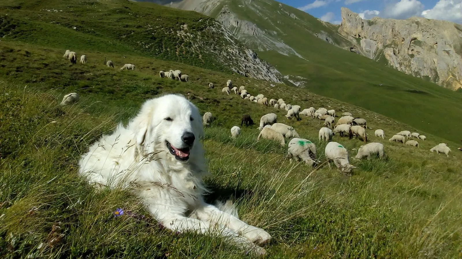
- The patou map to see where livestock guardian dogs are located
- Reporting tool to preview trail conditions and report obstacles you encounter
- Weather: 4-day forecast and 4-day past weather history anywhere in the world
A small selection of three hikes by the Vamos and Whympr team
The Grand Balcon Sud, a classic for admiring Mont Blanc
Chamonix – Aiguilles Rouges area
800 m of elevation gain
Probably the best viewpoint over the massif! Located in the Aiguilles Rouges Nature Reserve, you’ll likely spot ibex, as well as many other hikers. Start early in the morning to enjoy the cool air and sunrise.
The Grand Balcon Sud in Topo Pro format on Whympr.
Loriaz – Col de la Terrasse – Veudale – Montagne de Barberine
Vallorcine area
700 m of elevation gain if you sleep at the Loriaz huts, or 1,450 m if you start from the Couetray car park
A wild atmosphere! Between the Mont Blanc massif and the Emosson dam lake, you’ll enjoy a peaceful experience in nature.
Be careful of lingering snow patches at the Col du Passet before reaching the Loriaz huts. This is a technical section that requires dry conditions.
Loriaz – Col de la Terrasse – Veudale – Montagne de Barberine in Topo Pro format on Whympr.
Tête de Villy
Anterne area
500 m of elevation gain starting from the Anterne refuge
A stunning hike where you can admire Lake Anterne, the steep cliffs of the Fiz range, and the Fonds cirque. Always with views of Mont Blanc, but in a completely different atmosphere.
Tête de Villy in Topo Pro format on Whympr.
The trails are waiting for you!
Now that you’re eager to get out hiking, you know which book and which app to use to plan your mountain adventures. You’re already familiar with the classic advice: don’t feed marmots your chips, don’t pick a bouquet of edelweiss for your partner, don’t start a forest fire with a barbecue, and take your trash with you — chamois aren’t fans of canned goods.
A quick tip: don’t hesitate to contact La Chamoniarde, the high mountain office in Chamonix, if you have any doubts about trail conditions. They are up to date with current conditions and can help you prepare your hike. You can call them at +33 (0)4 50 53 22 08 or visit them next to the Chamonix church, and follow their Whympr profile where they regularly publish summary condition reports.
All that’s left is to wish you wonderful adventures! See you soon on Whympr or on the trails.
Download Whympr for free now on the App Store and Google Play. ⛰️