

Whympr represents a true innovation in the outdoor app landscape by bringing together, for the first time in one place, all the essential data needed to analyze avalanche risk.
You’ll find:
- Data Avalanche reports
- Official avalanche bulletins (BERA) worldwide
- Global slope angle layers
- Slope aspect layers
- Weather bulletins from the past 4 days
Until now, this information was scattered across different sources and platforms. It is now aggregated, structured, and directly usable within Whympr. No other outdoor app currently centralizes this level of avalanche data.
By cross-referencing these complementary data sets and working with expert partners such as ANENA and the Office de Haute-Montagne, Whympr becomes an essential decision-support tool—enabling a more detailed, precise, and responsible reading of mountain risk.
We explain each feature in detail below.
1 – Avalanche reports with Data Avalanche
Whympr now allows users to consult reports recorded in the Data Avalanche database directly within the app. Data Avalanche is a collaborative database that documents avalanches actually observed in the field.
Designed to centralize and share real-world feedback from mountain users, it records concrete events with precise information: location (mountain range, altitude, aspect), date, avalanche type, estimated dimensions, and snow and weather conditions.
Unlike forecast bulletins such as those published by Météo-France, which assess potential risk, Data Avalanche compiles observed facts. Each alert therefore corresponds to a real avalanche, helping improve understanding of field conditions and refine trip preparation.
To know more here: https://www.data-avalanche.org/
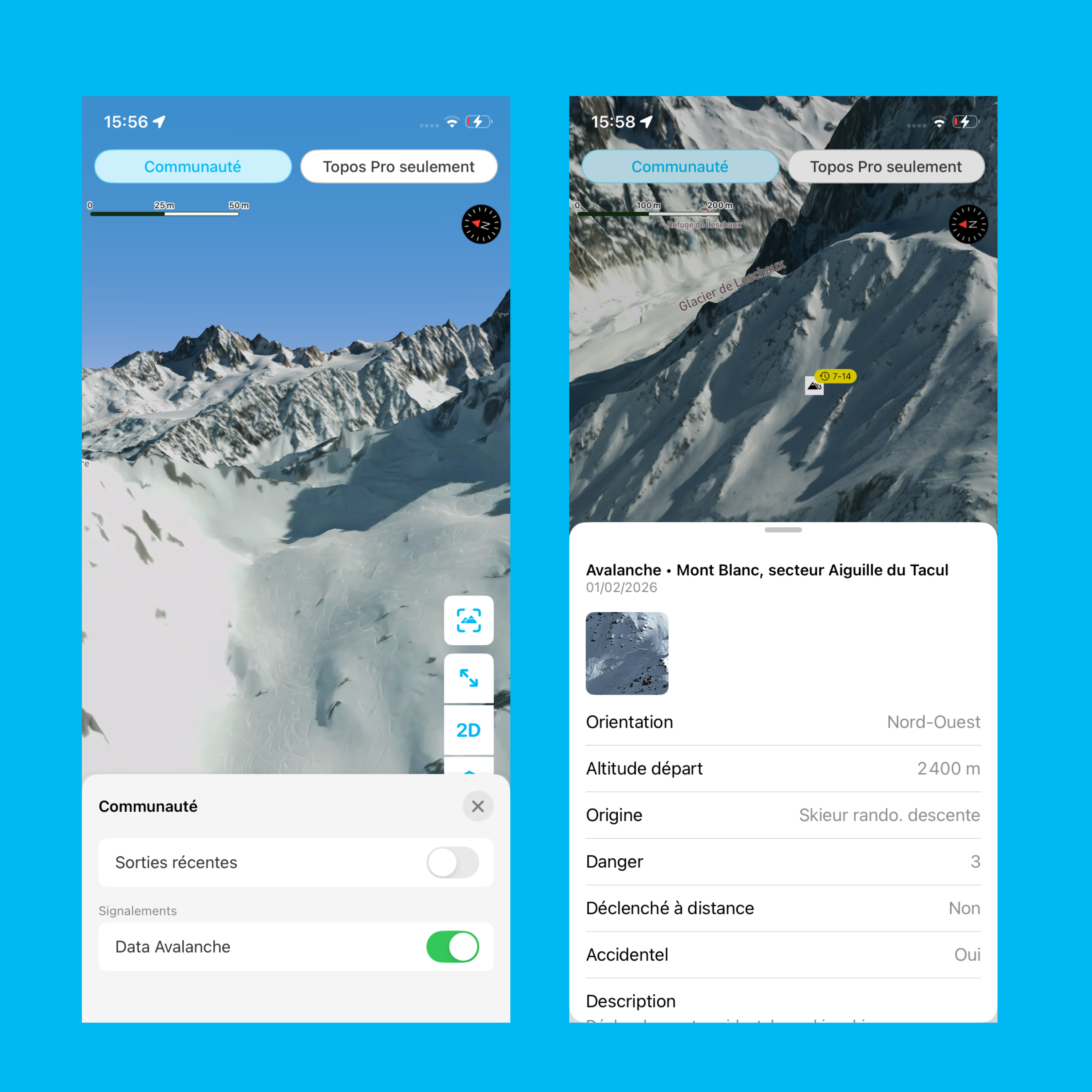
Good to know: Whympr will soon allow users to report avalanches encountered in the field directly from the app. Each report will enrich the map and database, providing a real-time view of risks and helping everyone prepare their outings more safely.
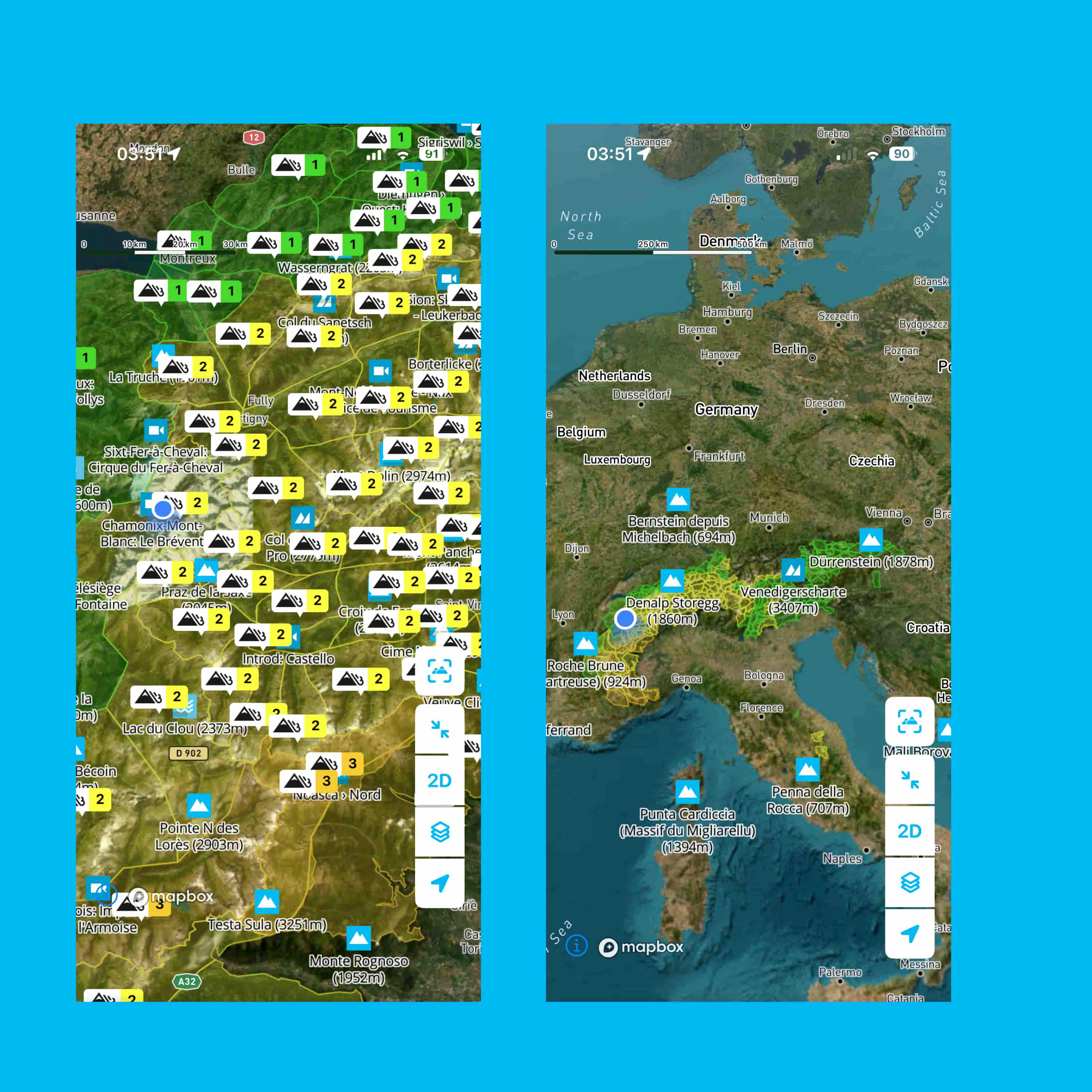
2 – Integrated avalanche bulletins (BERA)
Whympr aggregates official avalanche data from forecasting services. Users can consult the Avalanche Risk Bulletin (BERA), published and updated daily, which indicates the danger level, the most sensitive aspects, and the types of instabilities present in the snowpack.
Avalanche bulletins are available in the following countries: France, Italy, Switzerland, Spain, Andorra, Austria, Scotland, Canada, and the United States.
They can be displayed as a map layer to view them globally or at a specific location—such as on a particular point of interest (POI) or route.
To know more:
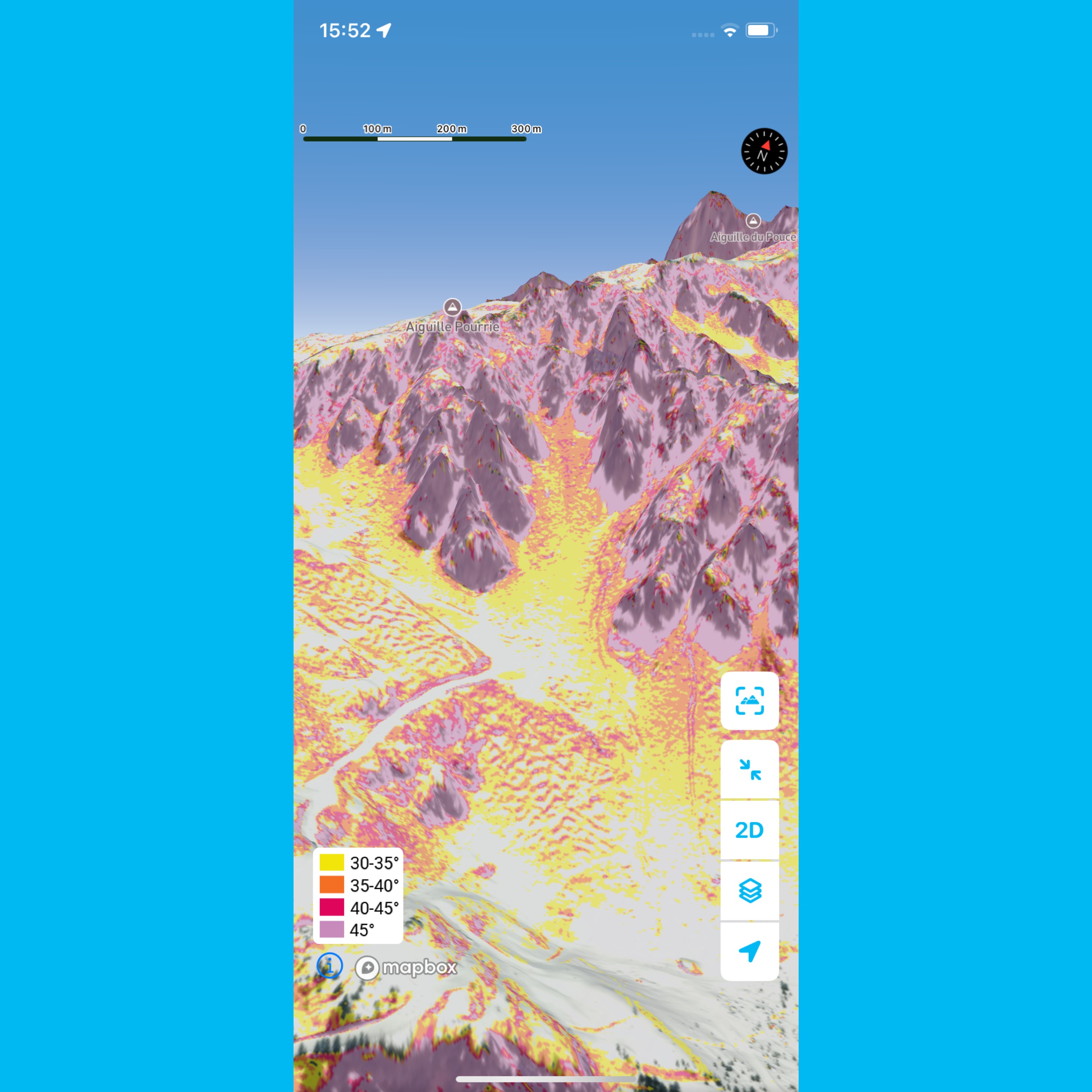
3 – Global slope angle layers
Whympr now integrates a highly precise slope angle layer powered by high-definition elevation data and digital terrain models (DTM).
The display updates in real time as you zoom in on the map, with each pixel corresponding to an actual field measurement. While the technical process behind it is complex, the idea is simple: provide the most accurate information possible to help users enjoy their outing while avoiding avalanche-prone terrain.
Users can choose between the IGN France layer, the swisstopo layer, or Whympr’s global layer—currently the most precise on the market for the Alps.
Legend is here.
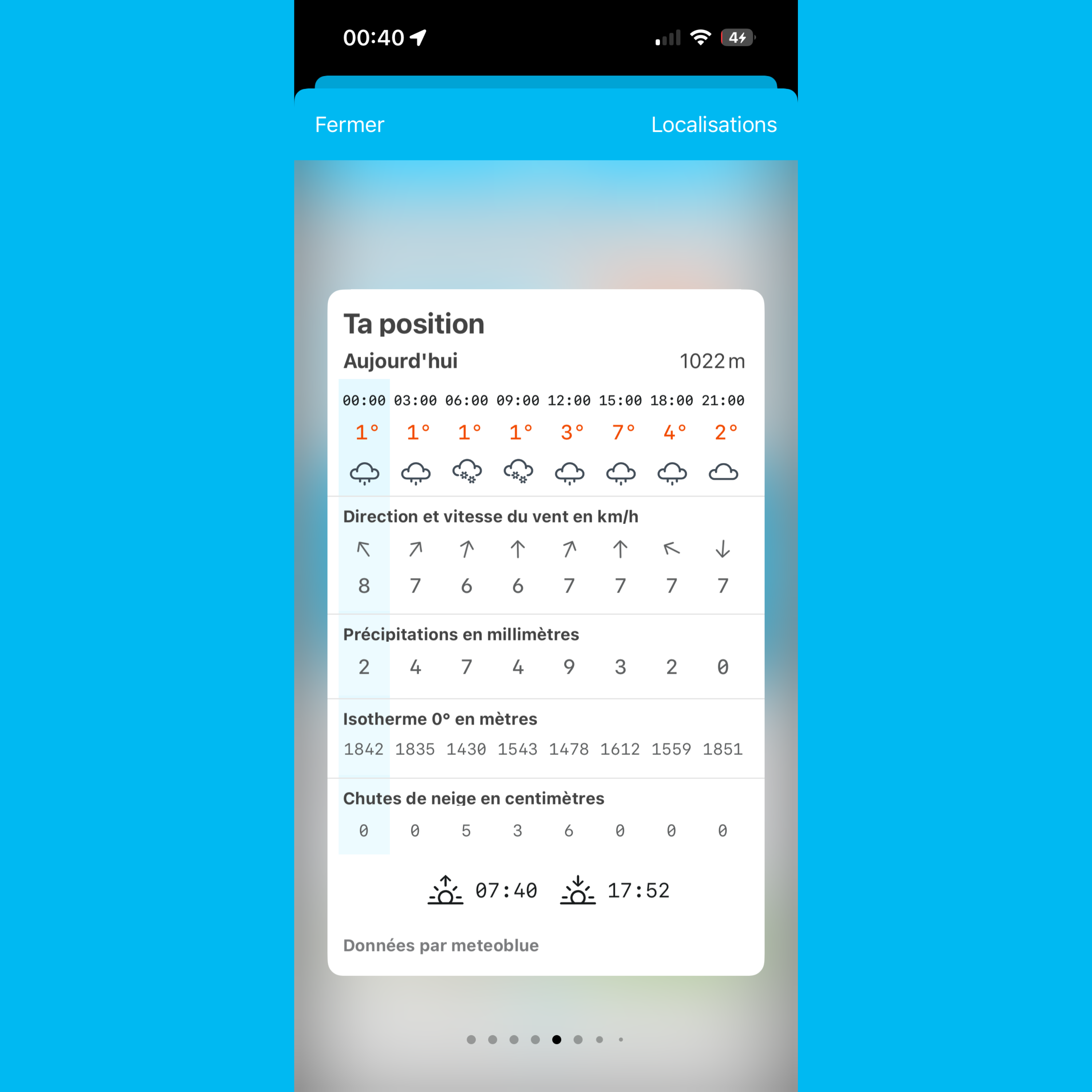
4 – Mountain weather bulletins
Weather conditions at altitude directly affect snowpack stability and route safety. Whympr integrates mountain weather bulletins in partnership with Meteoblue, including not only upcoming forecasts but also data from the previous four days.
This retrospective view makes it possible to analyze how conditions have evolved and assess snowpack stability more accurately, providing a comprehensive understanding of the context before and during an outing.
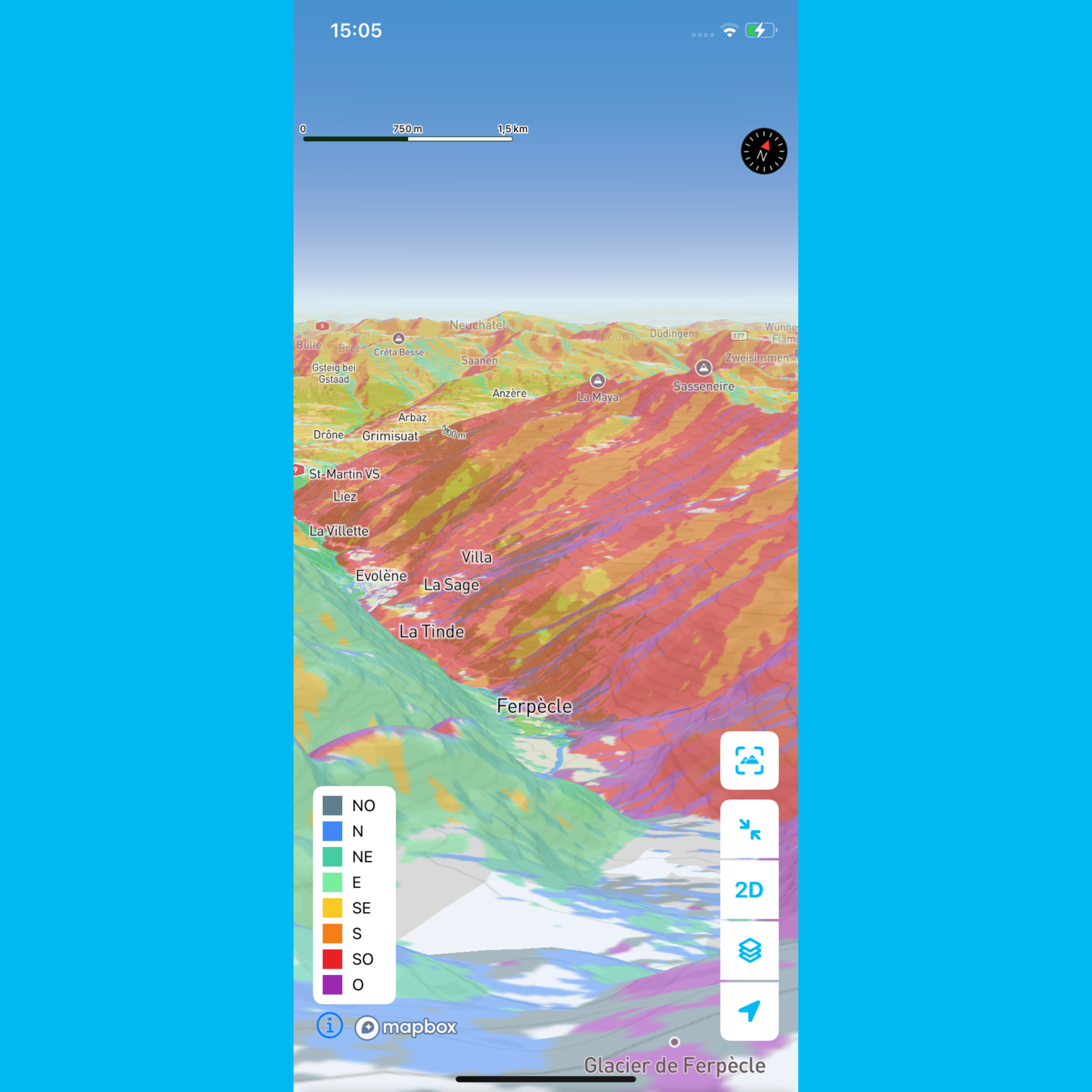
5 – Slope aspect layers
Whympr also includes slope aspect layers that allow users to visualize slope exposure (north, south, east, west)—a key element in the mountains, especially when assessing snowpack stability.
Aspect directly influences sun exposure, wind transport, snow transformation, and therefore the formation of wind slabs or persistent weak layers. For example, a north-facing slope will retain colder, potentially unstable snow for longer, while a south-facing slope will undergo more frequent freeze-thaw cycles.
Within Whympr, these layers can easily be cross-referenced with other available data, allowing users to adapt their route accordingly. It is a valuable tool for refining avalanche risk analysis and making more informed decisions in the field.
Partnerships with avalanche risk prevention experts
Beyond these tools, Whympr collaborates with ANENA (National Association for the Study of Snow and Avalanches) and the Office de Haute-Montagne, leading French organizations in avalanche risk prevention.
This collaboration strengthens the app’s educational dimension and helps promote best practices within the mountain community.
A comprehensive app…
By aggregating all official avalanche data into a single app, Whympr reaches an unprecedented technological milestone in the outdoor world. The app becomes a true pioneer in safe mountain trip preparation.
Where users once had to consult multiple separate sources, Whympr now offers a complete and integrated ecosystem, providing a precise and up-to-date overview of conditions. Each outing can therefore be planned with greater safety, confidence, and efficiency-whether for ski touring, ski mountaineering, or high-altitude hiking.
…but still a tool
Information from Data Avalanche and the data available in Whympr are valuable aids for preparation, but they do not replace the expertise of a mountain professional or your own on-the-ground analysis.
Avalanche risk assessment remains a personal responsibility, depending on the day’s conditions, the chosen route, and your experience. There is no such thing as zero risk in the mountains.
Whympr is a decision-support tool, designed to complement your judgment -never to replace it.


