The Tour du Mont-Blanc (TMB) and the Grande Traversée des Alpes (GTA) are among the most iconic hiking routes in the Alps. These legendary treks offer a unique immersion in the heart of the mountains, with spectacular panoramas, high-altitude mountain huts, and exceptional trails.
Whether you enjoy contemplative walking or multi-day trekking, these routes can be adapted to different levels and preferences: self-supported or hut-to-hut, solo or in a group, they offer a true adventure in the heart of nature.
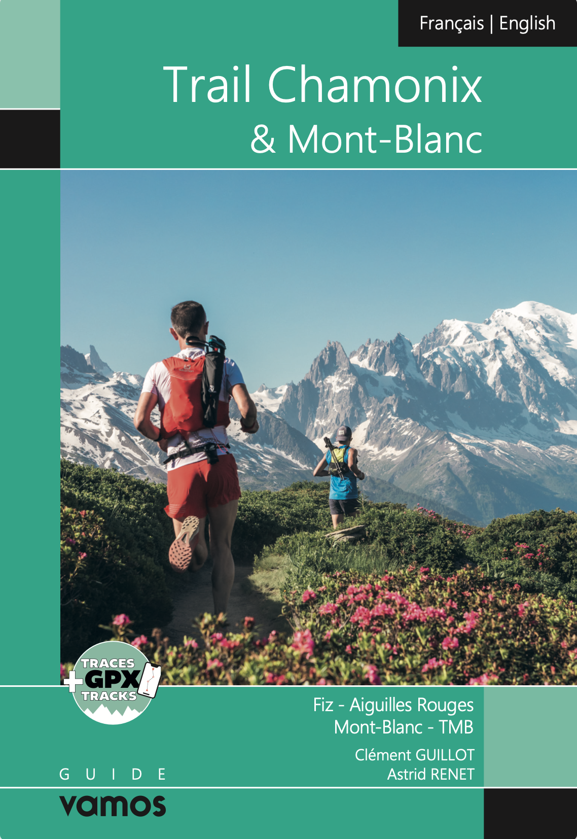
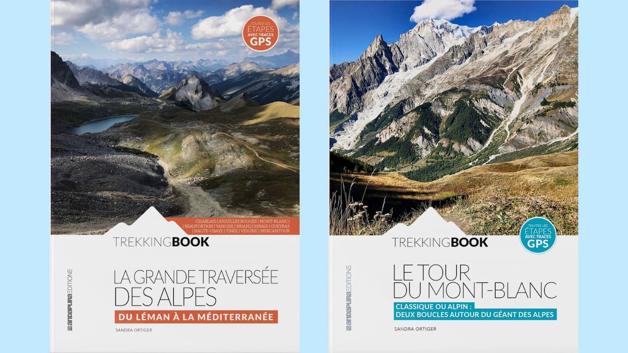
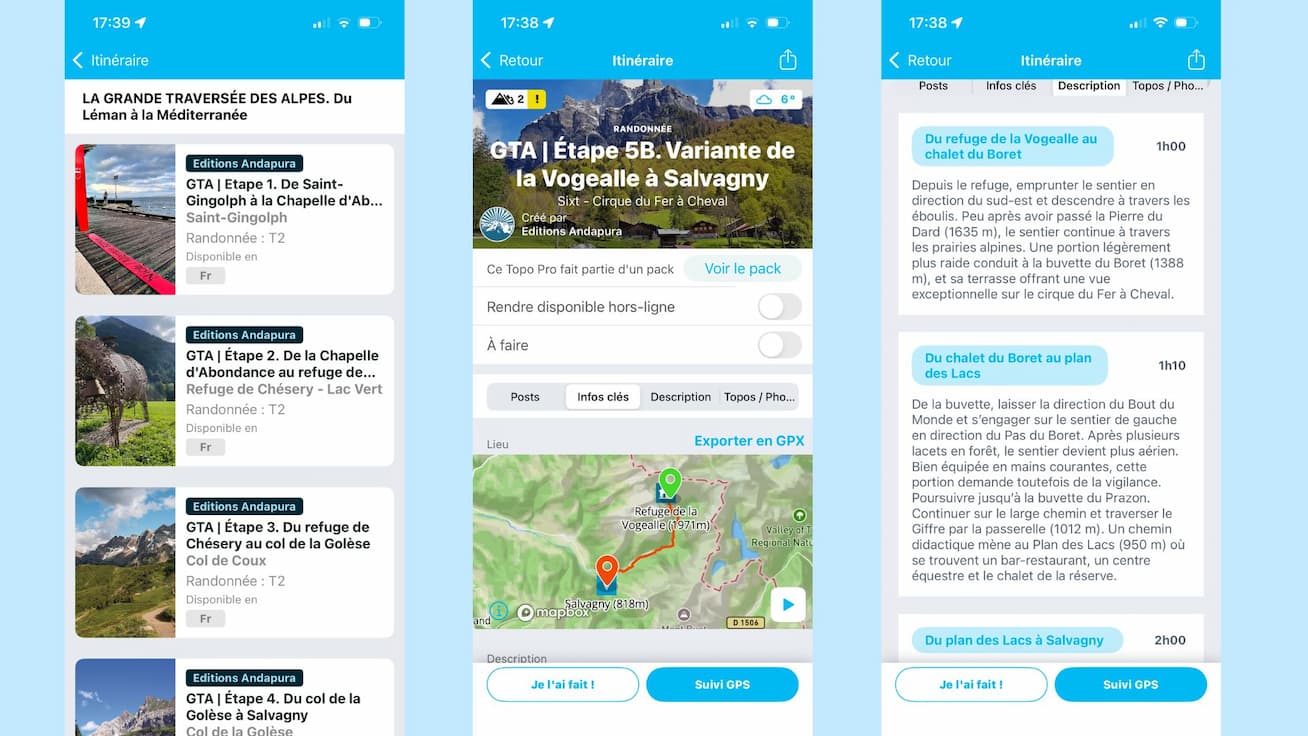
To make the most of these itineraries and prepare your trek safely, it is essential to rely on trustworthy route guides. On the Whympr app, you’ll find the Tour du Mont-Blanc and Grande Traversée des Alpes Pro Topos, created by Andapura editions by Sandra Ortiger, a qualified mountain leader. Detailed stages, practical advice, maps: everything you need to support you before and during your adventure.
Ready to set off?
Historical treks of the Tour du Mont-Blanc: in the footsteps of the first mountaineers
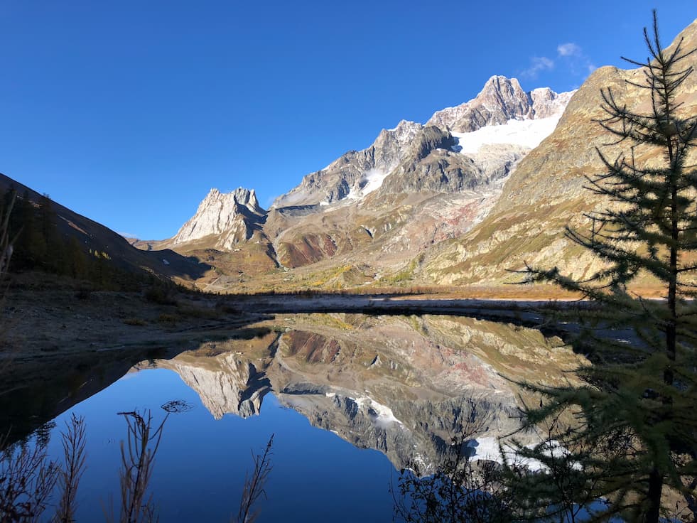
Today, the Tour du Mont-Blanc is the most popular long-distance trek in France. But it is far from a recent creation.
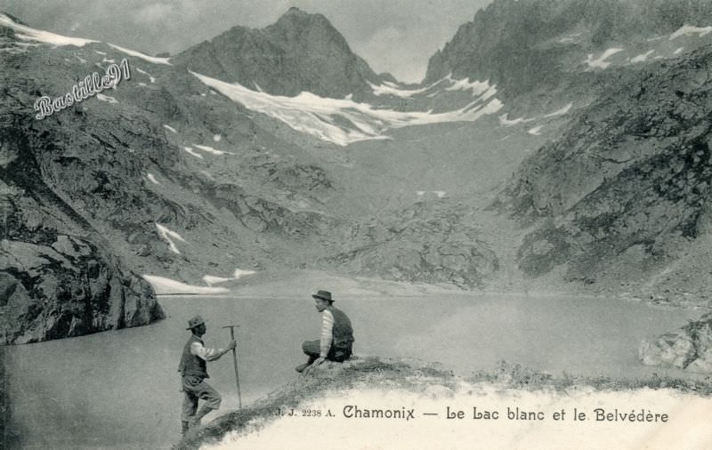
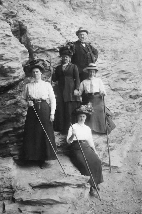
Long before the first hikers appeared, traces of trails circling the massif were already found. These paths were used by shepherds, hunters, itinerant traders, and even smugglers. The first recorded Tour du Mont-Blanc was officially completed in 1769 by two guides, Pierre Simon and Pierre-François Favret, alongside Horace-Bénédict de Saussure, travelling on muleback.
In 1800, Rodolphe Töpffer, one of the early theorists of art and a teacher by profession, introduced these famous trails to his students. He took the opportunity to write what would become the first guide to the Tour du Mont-Blanc, compiling the itinerary, the guides met along the way, and the places where he stayed overnight.
With highlights such as the Col des Fours and the Fenêtre d’Arpette, both reaching 2,665 meters, the classic Tour du Mont-Blanc is now typically divided into 9 stages.
More technical and alpine variations also exist, usually completed in 10 stages.
You can find both the classic and alpine versions in the Pro Topos published by Andapura, available in digital format on Whympr.
To conclude, here is a short 1967 video available on the INA website to discover a glimpse of the Tour du Mont-Blanc in the past.
The Grande Traversée des Alpes, an epic trek crossing an entire mountain range!
Now we’re talking about a real adventure. Imagine crossing the entire French Alps. To link Lake Geneva to the Mediterranean, you’ll cover around 620 km. This can be done section by section, with breaks between stages, or you can choose to hike only selected portions.
The Grande Traversée des Alpes crosses two national parks (Vanoise and Mercantour), four regional parks (Bauges, Chartreuse, Queyras, and Préalpes d’Azur), as well as six nature reserves.
The classic route is generally divided into four main sections:
- From Lake Geneva to Mont Blanc
- From Chamonix to Modane
- From Modane to Larche
- From Larche to Menton
As with the Tour du Mont-Blanc, variations of the route also exist.
You can find detailed descriptions and information for each stage in the Andapura Pro Topos, available in digital format on the Whympr app.
The marking of this major itinerary began in the late 1940s, led by the French Hiking Federation. The Grande Traversée des Alpes as we know it today was established in the 1970s. It later inspired its Italian counterpart, the Grande Traversata delle Alpi.
And finally, in 2021, Sébastien Raichon set the speed record for the Grande Traversée des Alpes (north-to-south direction) in 6 days, 6 hours, and 27 minutes. If you ever take on the challenge of beating it, let us know—we’ll come cheer you on.
The Andapura Pro Topos in Whympr
Sandra Ortiger is the author of the Tour du Mont-Blanc and Grande Traversée des Alpes Pro Topos available on the Whympr app.
Sandra started her career as a journalist and later worked as a creative director. Today, she is a qualified mountain leader based at the foot of Mont Blanc. She is also the founder of the exploration agency Andapura. For both individuals and organisations, the agency offers treks, nature retreats, deep-time walks, and outdoor seminars.
It was during the lockdown that Sandra began writing trekking books. Drawing on her experience as a mountain leader, journalist, and art director, she created her own publishing house and started producing guidebooks (including The Grande Traversée des Alpes, The Tour du Mont-Blanc in FR/EN, and Les Plus Beaux Tours face au Mont-Blanc).
So if you’re using high-quality trek guides in Whympr, she is the one to thank.
In the Andapura Pro Topos, you’ll find all the information you need to prepare your trek properly:
- A large overview map of the entire route to visualise the journey
- Both the classic version and the more technical alpine variation of the treks
- Estimated walking time for each day
- Distance in kilometres
- Positive and negative elevation gain
- Maximum altitude
- Mountain huts, hotels, campsites, and bivouac areas available between stages
- Bars and restaurants along the way for a well-deserved break
- Bus, train, and cable car connections to link or shorten stages
- Shops for small supplies
- ATMs
- Tourist offices
This content gives you curated and verified information provided by a mountain professional. In addition to technical route data, you also benefit from exclusive advice and contextual notes on nature and local heritage, helping you go beyond the purely sporting aspect.
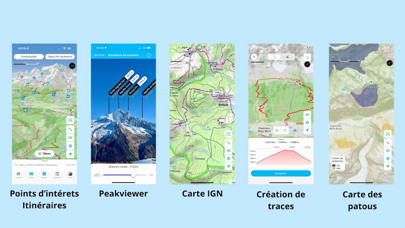
The digital version of these guidebooks in Whympr, under the name Pro Topos, complements the richness of Sandra’s printed books. Among their key advantages are GPX tracks for each stage, the ability to view them on IGN maps, Fraternali maps for Italian sections, and Swisstopo maps for Swiss sections, offline access to the guides, and the convenience of having everything directly on your phone.
It’s worth noting that purchasing the Tour du Mont-Blanc or Grande Traversée des Alpes books from Andapura editions gives you free access to their Pro Topo version in Whympr.
But let’s take a closer look at what Pro Topos actually are.
Digitalised hiking
These guidebooks, along with many others available on the Whympr app, are called Pro Topos.
First of all, what is a Pro Topo? It is a guidebook written by qualified professionals, offering high-quality, reliable information and available for purchase directly in the Whympr app (individually or as part of a pack).
You can find The Tour du Mont-Blanc and La Grande Traversée des Alpes by Andapura editions as a bundle, but you can also purchase itineraries individually or by section—for example, only specific stages. As with printed guidebooks, a percentage of each sale is paid back to the authors.
The digital format offers many advantages. Whether for hiking, snowshoeing, ski touring, or mountaineering, Pro Topos give you access to GPX tracks for all routes.
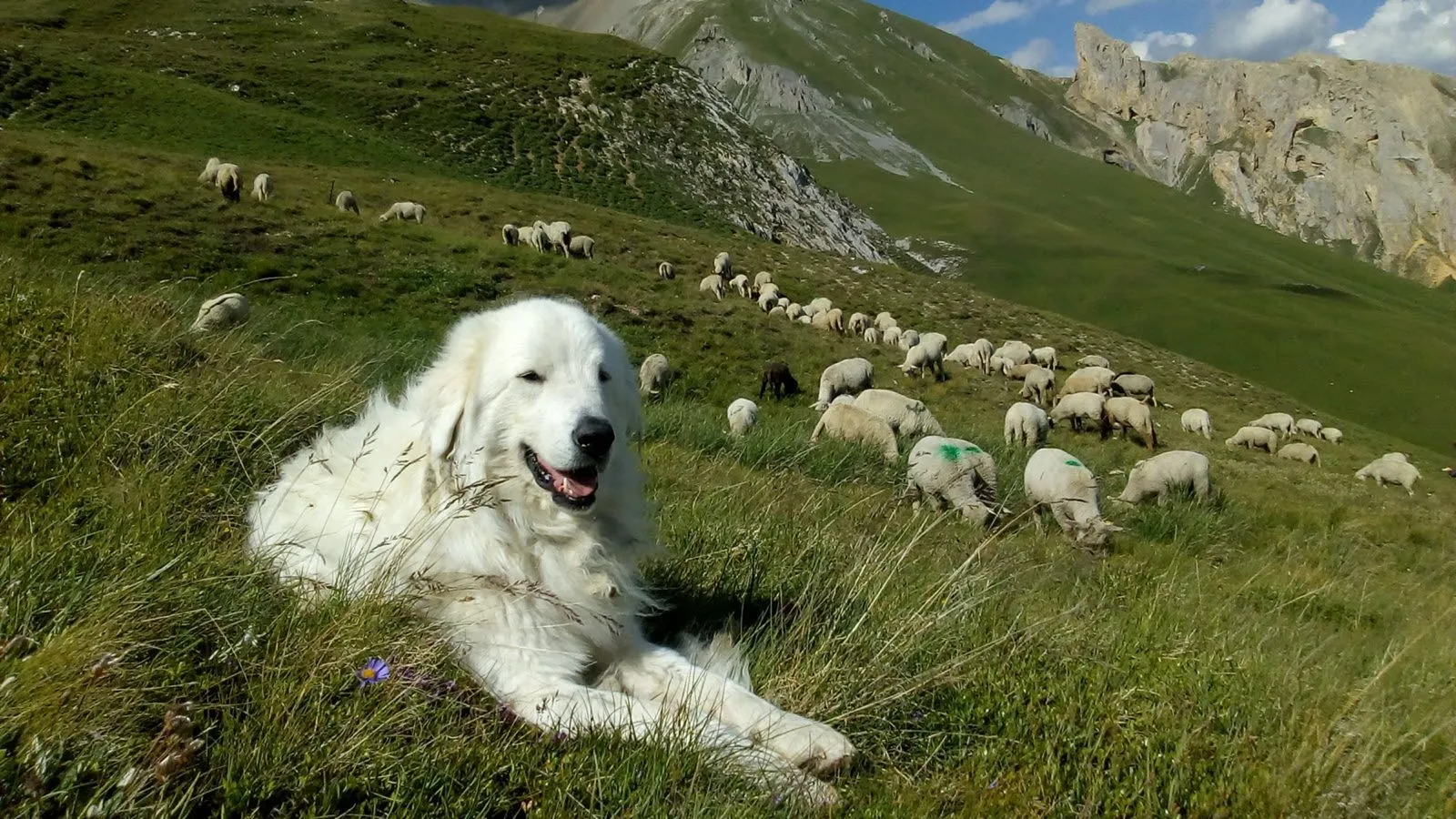
You can also easily find the exact guide you’re looking for, locate it on the map, and always have it with you in the mountains. With the Whympr Premium version, you unlock additional useful features for your Pro Topos, such as offline access, weather forecasts, route display on IGN maps, the ability to record and share your GPX tracks, view areas with livestock guardian dogs (“patous”), and many other tools.
As mentioned above, the Andapura guidebooks for the Tour du Mont-Blanc and the Grande Traversée des Alpes are available in Whympr. If you own the printed book, you also get free access to the Pro Topo version in the app.
If you want to learn more about Pro Topos, we invite you to read our dedicated blog article, where you’ll also find a list of all Pro Topos available in Whympr. You can also watch our tutorial on YouTube.
Hiking in the Calanques or the Gorges du Destel, climbing in Chamonix, and more—you’re sure to find something you love. Combine the pleasure of browsing the printed guidebook at home to compare and plan your route, then have everything you need right on your phone once you’re in the mountains.
The Whympr app, your hiking ally
These Pro Topos are available exclusively on Whympr, making it the perfect opportunity to discover all the app’s features designed to support your hiking adventures.
Most of these features are available with a Whympr Premium subscription (€24.99 per year). Feel free to try it out—you get a one-week free trial to decide.
Among the many tools offered by the app—designed for hiking, ski touring, climbing, and mountaineering—here is a selection of features that might interest you:
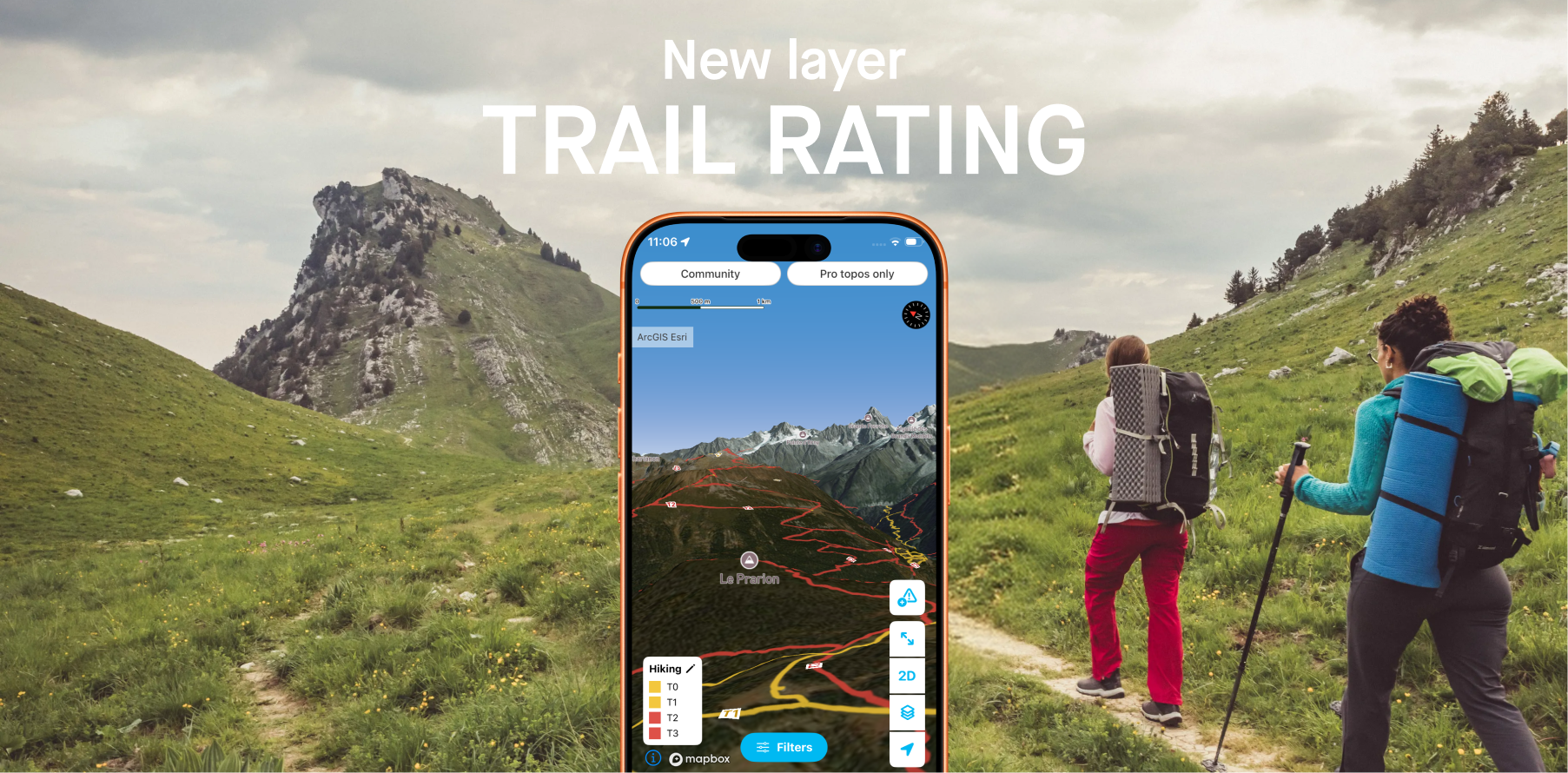
- Mapping tools: access global map layers such as IGN, Swisstopo, or Italian maps… You can view them in 3D and add overlays (slope angle and aspect, flat areas for bivouacs, sensitive wildlife zones, etc.).
- Route tools: create, record, and download tracks for offline use, and more.
- 100,000 points of interest and routes worldwide, plus hiking tracks across France and Switzerland
- Offline routes and maps for use without network connection
- Peak View to identify and visualise surrounding summits
- 28,000 webcams worldwide
- “Patous” map to locate livestock guardian dogs
- Alerts & reports to check trail conditions in advance and share obstacles you encounter
- Weather forecasts up to 4 days ahead and 4 days back, anywhere in the world
Feeling inspired to go trekking?
We hope we’ve inspired you to hit the trails this summer! Plenty of amazing adventures are waiting for you in the mountains—and now you know the right guidebooks and the right app to help you prepare properly 😁
A quick tip: don’t hesitate to contact La Chamoniarde, the mountain safety and high-altitude office in Chamonix, if you have any doubts about trail conditions. They have up-to-date knowledge of mountain conditions and can help you plan your hike safely. You can call them at +33 (0)4 50 53 22 08, visit them directly next to the church in Chamonix, or follow their Whympr profile, where they regularly publish summary bulletins on current conditions.
Download Whympr for free now on the App Store and Google Play. ⛰️