Hiking
Whympr
23
June
2026
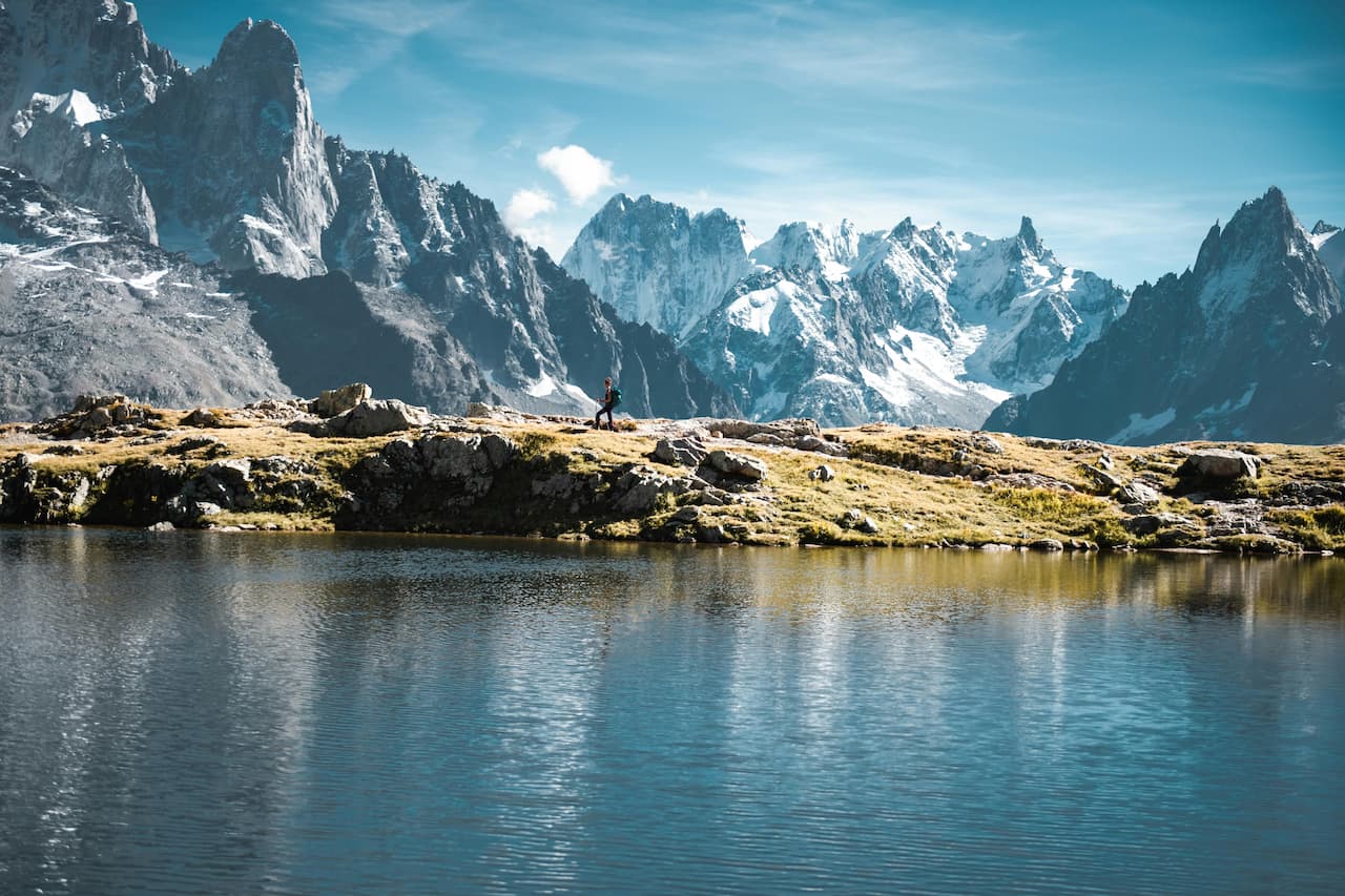
Explore 30 Trail Routes in Chamonix & Mont-Blanc
Tutorial
15
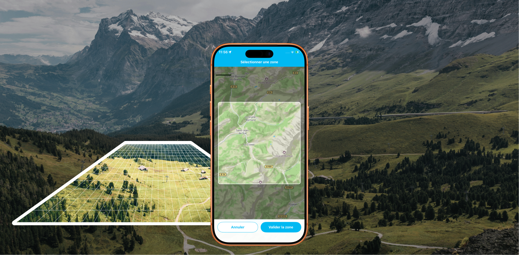
Offline Maps: Download areas from anywhere on Earth and travel without a data connection with Whympr
Alpinism
10
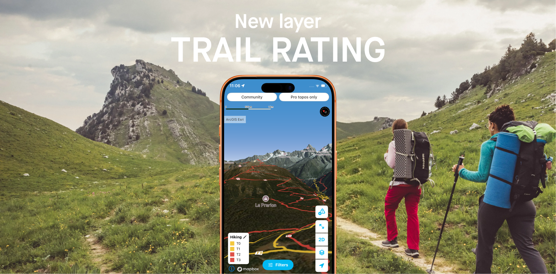
Whympr introduces 2 new layers to display the difficulty ratings of all hiking trails around the world.
26
May
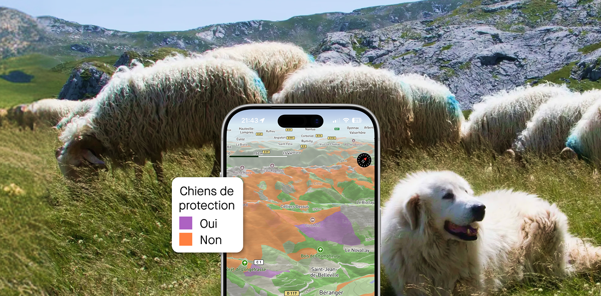
Plan your hikes with peace of mind this summer in France and Switzerland with the new “guard dog zone” overlays
05
Access the Tour du Mont-Blanc and Grande Traversée des Alpes Pro Topos in digital format on the Whympr app
Ski touring
Ski
24
April
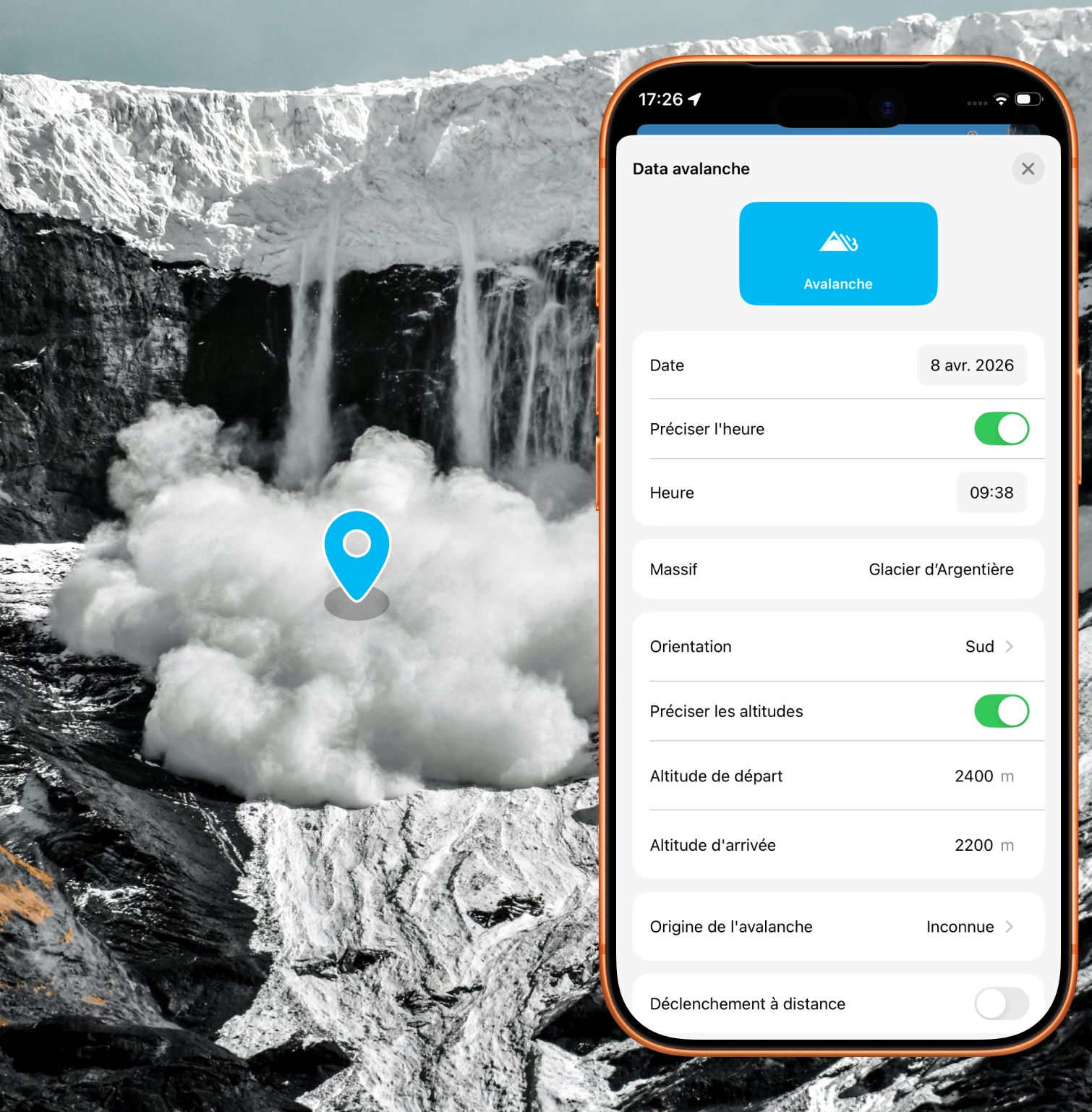
Alert the community and report avalanches quickly with just a few taps in the app
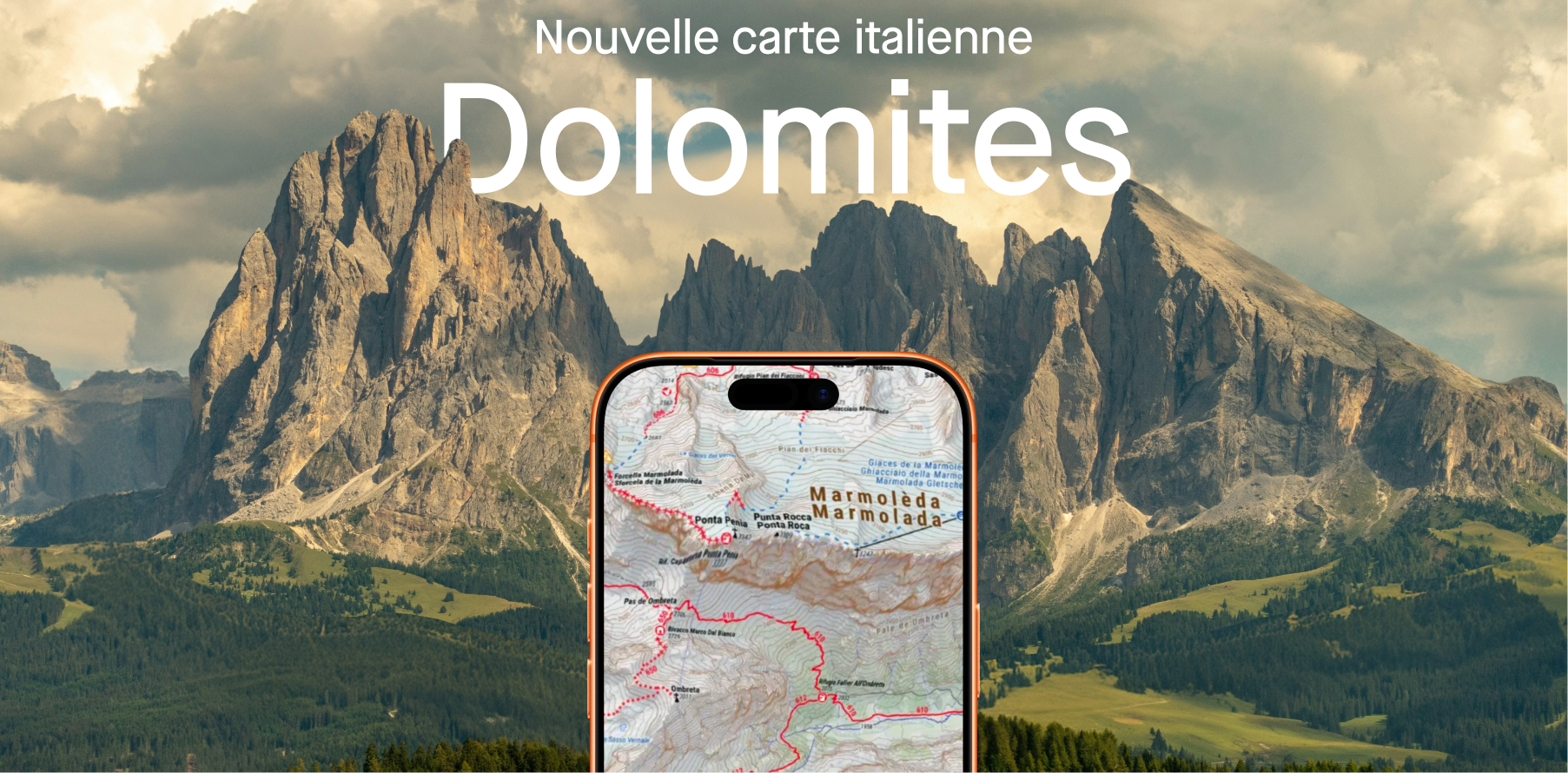
Plan your next hikes and treks in the Dolomites.
11
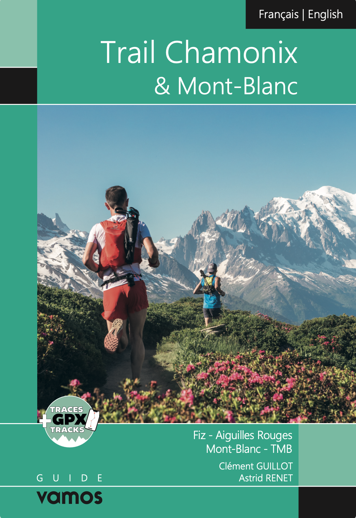
Explore the most breathtaking hikes in the Mont Blanc massif with the Vamos guidebook, featuring detailed routes, hidden gems, and unforgettable alpine adventures.
25
March
Explore the new Whympr winter satellite maps for ski touring in Belledonne and Zermatt (Matterhorn & Monte Rosa).
16
Discover Whympr’s new feature: report and check hazards and obstacles before your outdoor outing.
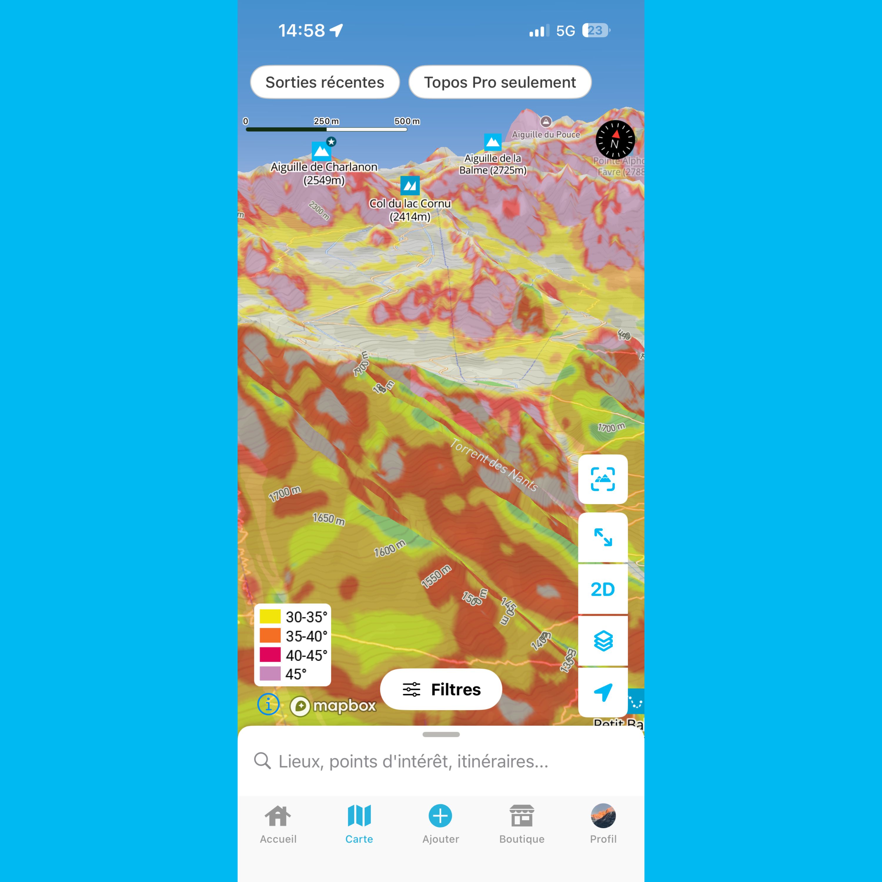
This article helps you understand slope gradient layers in Whympr
Whympr poursuit l’aventure avec Léo Slemett et Marion Haerty, et accueille Liv Sansoz
Climbing
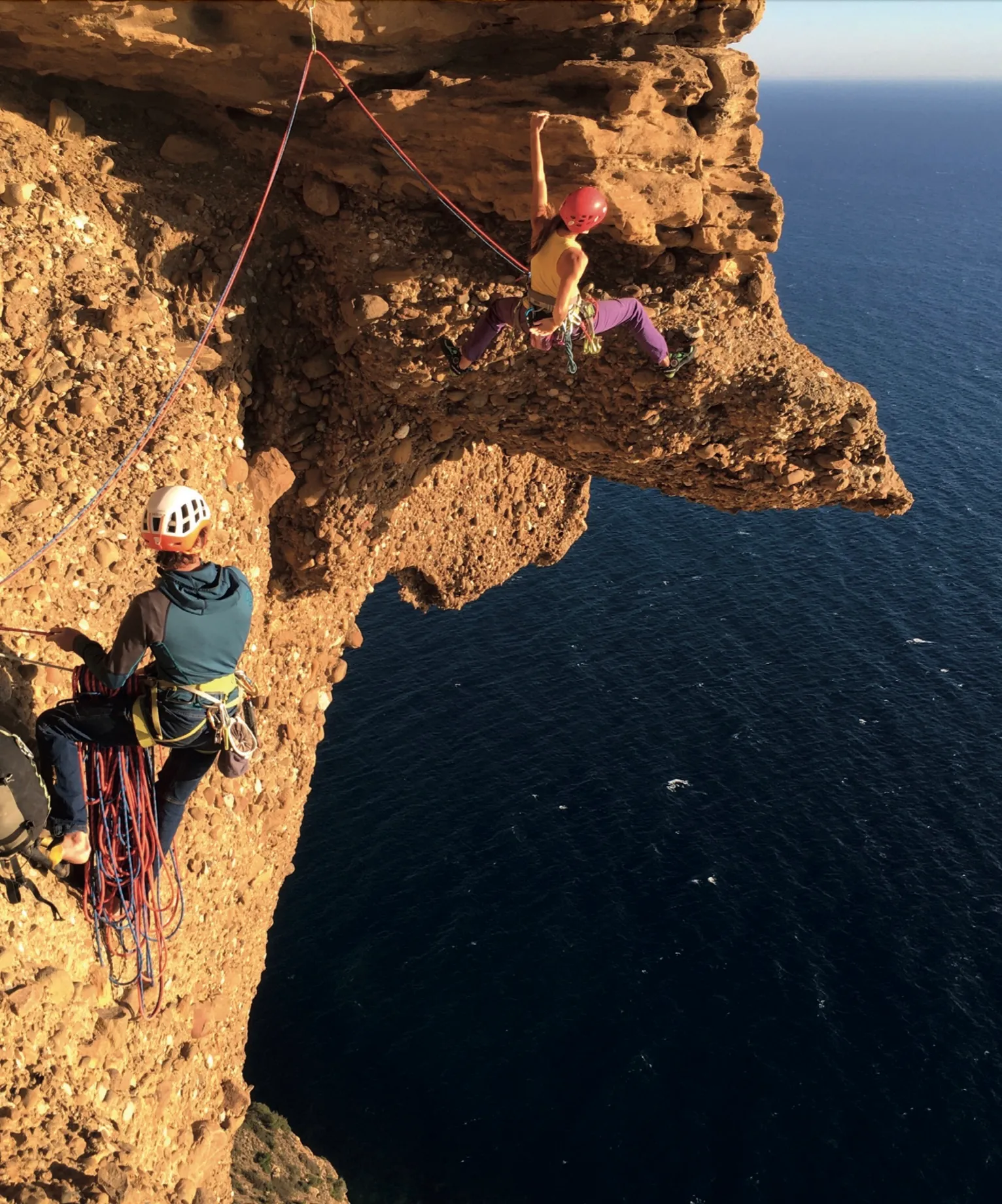
Découvre tout de l'escalade dans les calanques avec Whympr.
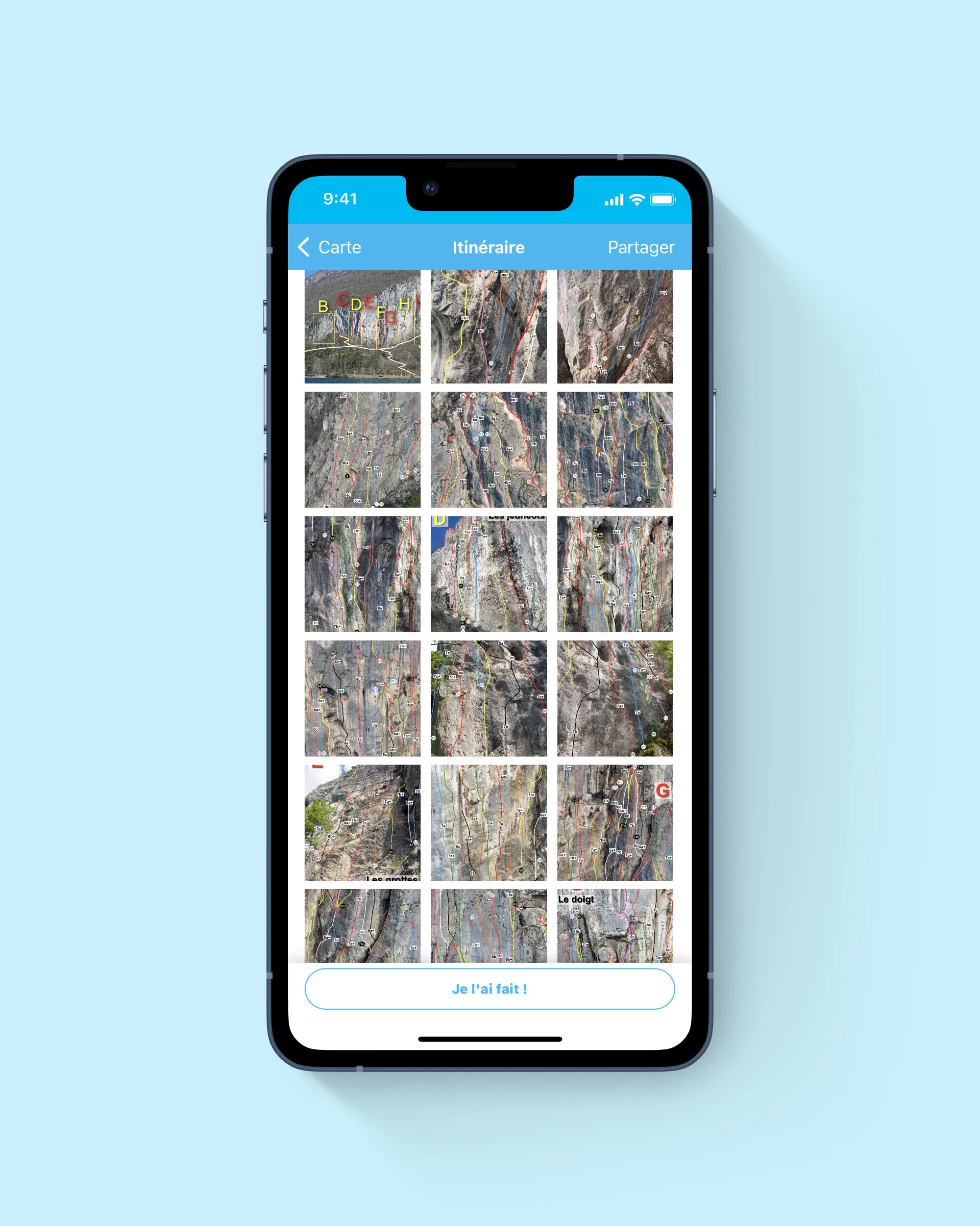
Découvre le tout nouveau topo d'escalade de la falaise du Biclop à Annecy sur Whympr
Equipement
Voici un petit aide-mémoire sur les cotations d’alpinisme et les critères pris en compte pour les déterminer afin de déchiffrer les lettres, les graduations et les - /+ qui peuvent parfois paraître un peu énigmatiques.
Toutes les nouveautés autour de Whympr, actualisées toutes les semaines, c'est par ici !