Whympr presented by Tim MacLean, in video
In this presentation, Tim MacLean, co-founder and President of Whympr, will guide you through the incredible features of our app. Discover how Whympr can empower you to plan, track, and share your outdoor outings like never before!
If you prefer reading, here it is:
Hello friends! This is Tim, the co-founder and President of Whympr, the app dedicated to hiking, mountaineering, climbing, and ski touring enthusiasts. From our headquarters in Chamonix, I will take a few minutes to introduce you to Whympr and show you everything you can do with this app.
From the beginning, our ambition with Whympr has been to create an app where you can find all the necessary information to prepare for your outdoor outings, anywhere in the world. Whether it's for hiking, mountaineering, climbing, or ski touring, Whympr brings together everything you need in one place.
The first page of Whympr is a wall where you can see recent outings from the community. Unlike a classic social network like Facebook or Instagram, the goal is to provide you with current information about mountain conditions. For example, by viewing the photos and routes shared by other users, you can check if there is still snow on the trails or if certain areas are passable.
Whympr also offers essential tools for preparing your outings. You can get the weather for your current location or other places you choose, with forecasts for four days. We have a partnership with Météo Blue to provide you with accurate weather information, including specific data like the freezing level. Additionally, you can check avalanche bulletins for various regions, including France, Switzerland, Italy, and the United States.
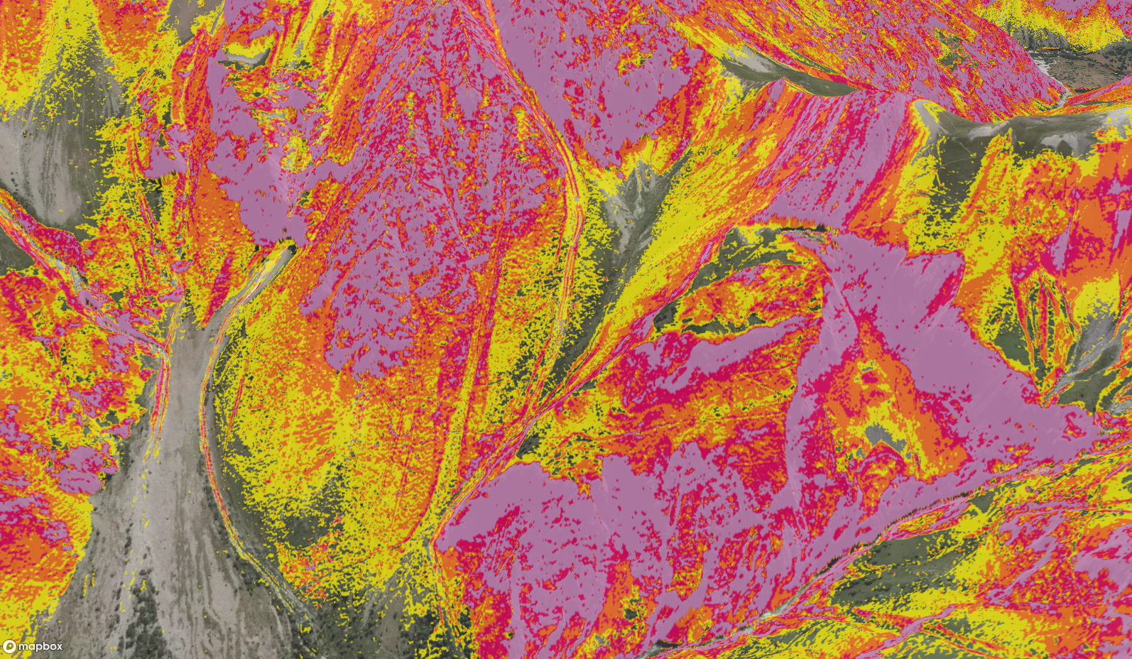
The map is one of the most important features of Whympr. We offer a free global topographic map via Mapbox, and you can also choose different base maps like satellite view, SwissTopo, the Italian Fraternali map, and in France, the Scan25 map from IGN. You can switch to 3D mode for a better understanding of the relief and terrain and display slope inclinations, which is particularly useful for ski tourers.
Whympr gathers over 100,000 routes and descriptions of points of interest like summits, huts, cliffs, and lakes. We aggregate content from free sources like Camp to Camp and SkiTour, as well as paid content created by professional authors and publishers. You can filter these points of interest by activity, difficulty, and other criteria to find exactly what you are looking for.
We have recently added an augmented reality feature for summits, available on iOS and soon on Android. Using GPS, you can identify and explore the summits around you. Another interesting feature is the ability to create hiking routes. You can say "I'm here" and "I want to go there," and Whympr will create the shortest path with elevation gain and distance. You can also draw your own route and save all this information for offline access.
Once your route is saved, you can easily share it with your friends on WhatsApp, by email, or via other apps like Iphigénie. Your profile on Whympr acts as a logbook where you can find all your stats, your outings from the past 30 days, and all the items you have saved offline.
That's the basics of Whympr. I hope you enjoyed this presentation. Feel free to send us messages or questions through our site. Please know that we are a small passionate team, and we will continue to develop new features to help you prepare for your outings. Thank you and see you soon!