

.webp)


The world’s most accurate winter map is on Whympr
Whympr is taking you off the beaten path with an awesome new winter map of the Mont-Blanc massif, crafted to upgrade your mountain outings.
It features incredibly detailed HD satellite imagery that makes you feel like you’re really there.
But that’s not all.
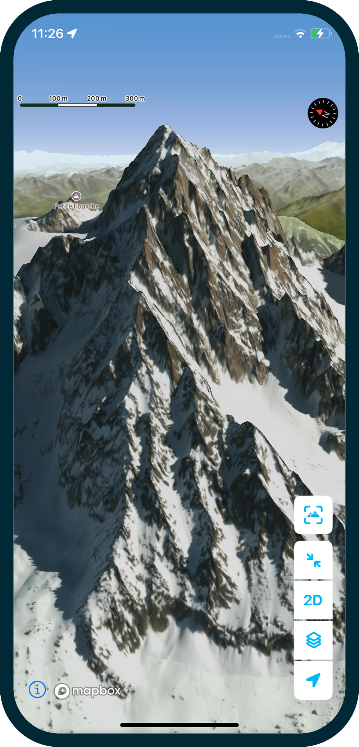
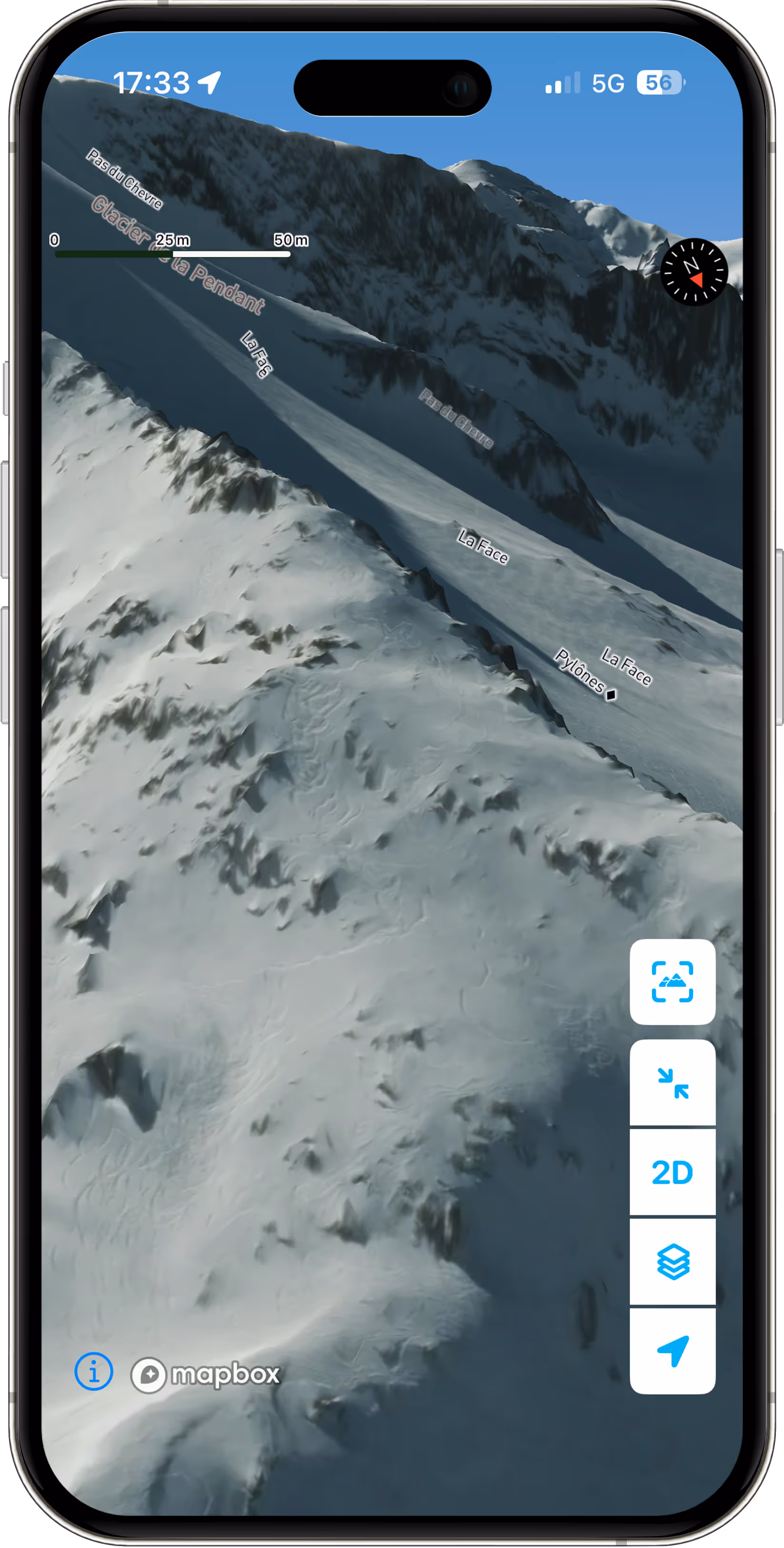
You’ll also enjoy a revolutionary 3D experience, enhanced with LiDAR technology so you can visualize every ridge, valley and slope with unmatched precision. LiDAR is available in France, Italy, Switzerland, Germany, Austria, and Spain.
And the last best news?
👉 This map comes with the Whympr Premium subscription for just €24.99/year.
A tech leap for your outdoor adventures
To create the best winter map possible by 2026, we made a bold move: we sent satellites to capture ultra-high-definition images.
The result? Today, we have the world’s sharpest commercially available satellite imagery for a map - 30 cm per pixel (an insane level of detail that makes it feel almost real) - and some of the most recent winter shots you’ll find, from February 2025.
Add 3D LiDAR technology on top of that… boom!
The best winter map of the Mont-Blanc massif is now right in your pocket.
👉 Read More (A Must-See Article)
This is just the beginning
The HD winter satellite map is now available for the Mont-Blanc massif… for now.
Why Mont-Blanc?
It’s our home base, the starting point of Whympr, and one of the most iconic and challenging outdoor playgrounds in the world.
Why not elsewhere? Simply put, satellite imagery is very (very) expensive. As a French startup, we can’t yet afford to cover every mountain range right away.
But we do want to expand our maps worldwide.
👉 And this is where your opinion matters: tell us which mountains we should map next!
By answering this short survey, you’ll help shape the future of the Whympr adventure.


