Your outdoor outing starts here

The all-in-one app to plan your outdoor outings, wherever you are in the world

Watch the video

Over 100,000 routes and POIs

Prepare for your outdoor outings

Access over 100,000 itineraries and points of interest, and plan your outdoor adventures, summer or winter, with detailed descriptions for each route.

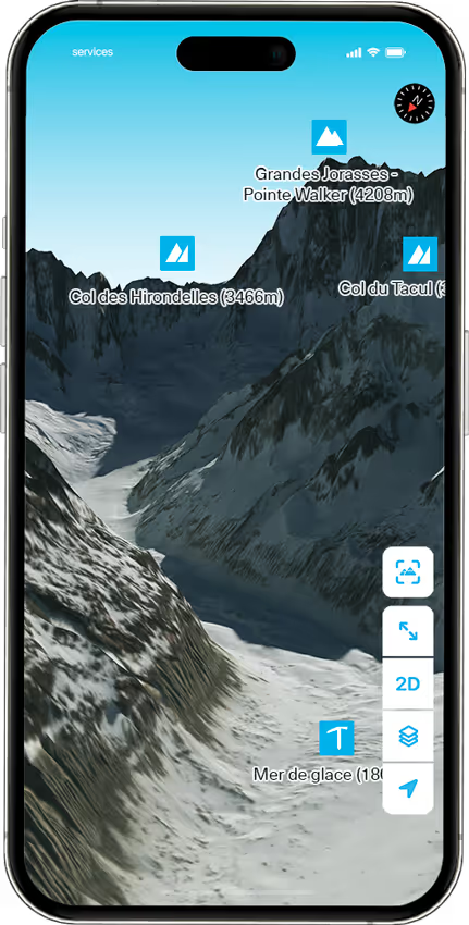
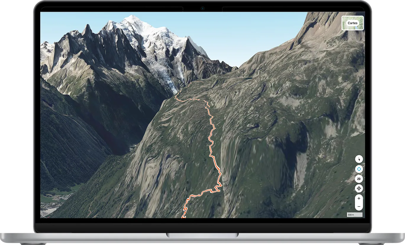
Visualize the terrain and your tracks in 3D.Access 15 topographic map layers, including IGN, SwissTopo, USGS, and high-quality Italian maps.

See tracks directly on the map, such as ski touring routes from the Petzl Foundation in France or SwissTopo in Switzerland.

Use the filter to search for routes by skill level, activity type (ski touring, hiking, climbing, off-piste, snowshoeing…) and duration.

Identify surrounding peaks in real time with the Peak Viewer, an augmented reality tool.

Use offline mode by downloading your routes and the associated map to access them without a network connection.

Weather and Avalanche Bulletin

Anticipate weather conditions

Check the outdoor weather and avalanche bulletins in real time.

Check the slope angles and identify avalanche-prone areas before your trip.

View the last 10 days of outings on the map from other users to study their routes, feedback, photos, or contact them to learn more about terrain conditions.

GPS tracking and community

Record and share your outings

Create and save your GPS tracks before or during your outing, analyze your statistics, and share your trips with a community of enthusiasts.

Get inspired by their adventures in hiking, climbing, mountaineering, or ski touring.

Review your route or others’ with the Fly Over feature (3D route preview).

GPS tracking

A tu euismod vulputate vitae ligula presently vel convallis. Mauris volutpat purus nullam massa.

Community activity wall

A tu euismod vulputate vitae ligula presently vel convallis. Mauris volutpat purus nullam massa.

Explore the full potential

Discover all Whympr's free and Premium features.

Discover all the features

New! Our Web App

La web app pour planifier tes itinéraires depuis l'ordinateur en 3D
Logo Web App

Web App

The new tool to prepare your routes from your computer
Check
Create routes on a large screen
Check
Access 70 map layers
Check
Draw your routes
Check
Mark waypoints
Check
Manage routes and waypoints
Check
GPX Export
Check
3D Maps
Create a routeCopy link
Accessible from your computer

Our ambassadors

Liv Sansoz

Twice a world climbing champion, Liv’s also a mountaineer, skier, paraglider, and base jumper — hard to sum her up in one word. She’s a true explorer at heart, always in tune with the spirit of the mountains. In 2017, she took on a wild challenge: climbing all 82 Alpine peaks over 4,000 meters. With two world titles and three World Cup wins in both lead and bouldering, Liv also became the second woman ever to climb an 8c+ route, way back in 2000.

Léo Slemett

Léo Slemett is a renowned French freerider from Chamonix. Freeride World Champion in 2017, he is known for his bold descents and deep connection to the mountains. Passionate about skiing and mountaineering, he combines technical skill and creativity to explore challenging terrains while advocating for an environmentally respectful approach.

Marion Haerty

Marion Haerty is a French freeride snowboarder and multiple-time Freeride World Tour champion. She embodies excellence in her sport and inspires many young athletes to pursue their dreams. But what makes her even more remarkable is her commitment to promoting women’s participation in mountain sports.

Julien "Pica" Herry

Guide and Snowboarder and Alpinist of the extreme.

Downloads to date

637 000

Nice satisfaction :) Complete application with the possibility with the subscription to download many maps according to where we are in the background including IGN. The little extra we can exchange with the developers!

Thanks to Whympr I found a great hike and I love seeing the pictures on the map. I 💕💕💕 whympr.

The mountain app that's on the rise! Perfect to follow your runs and get ideas/info on the conditions. Plus: the BERA of the right massif at the right place, the weather, the reports of the outings, the map of the slopes.

Great application, intuitive, which greatly facilitates mountain outings and allows you to discover new nice places. I recommend it!

Download Whympr now

Télécharger

Whympr's commitment to the planet

Sustainable Development Charter

The purpose of this document is to provide a fair and unbiased picture of the positive and negative impacts our company has on the planet and to set goals for the company to reduce its impact on the planet.

Consult the sustainable development charter

Our historical partners

Partner logo
Partner logo
Partner logo
Partner logo
Partner logo
Partner logo
Partner logo
Partner logo
Partner logo
Partner logo
Partner logo
Partner logo
Partner logo
Partner logo
Partner logo
Partner logo
Partner logo
Partner logo
Partner logo