Understanding slope gradient layers in Whympr
The slope gradient layers in Whympr are analysis tools designed to help you plan your outdoor outings. This article explains how they work, where the data comes from, and best practices for using them.
Analysis tools based on modeled data
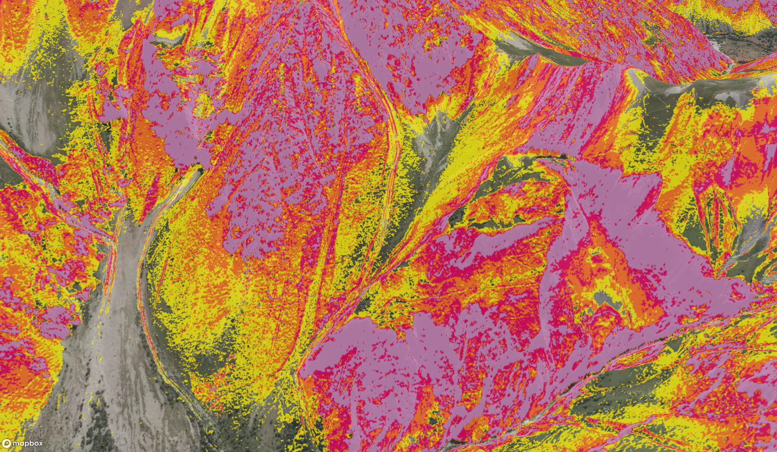
Slope gradient layers are calculated from a digital elevation models (DEMs). These are modeled data, not direct field measurements.
Like all mapping data, they have limitations -especially in complex terrain (cliffs, steep breaks, glaciers, dense forests, etc.). No source, not even national references, can be considered perfectly accurate or complete.
These layers should always be used with caution and cross-checked with other sources: topographic maps, guidebooks, recent conditions, and field observations. They are not a substitute for experience or personal judgment.
A multi-source approach
Whympr’s goal is to bring together as much relevant data as possible to help outdoor enthusiasts better plan their mountain outings.
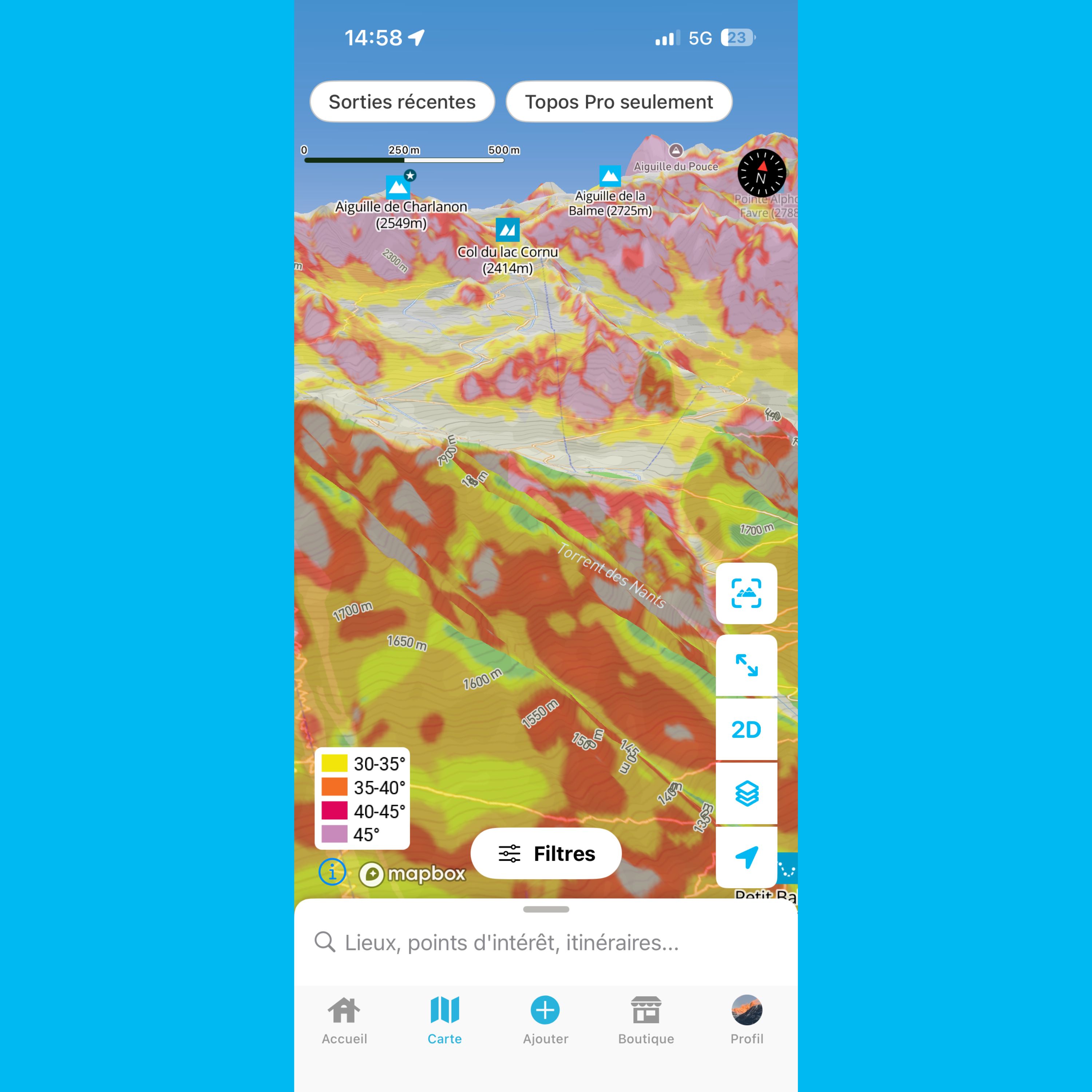
That’s why Whympr offers multiple slope gradient layers from different sources, allowing users to pick the data that best fits their terrain.
Currently, Whympr provides:
- an IGN model for France,
- a SwissTopo model for Switzerland,
- a world model.

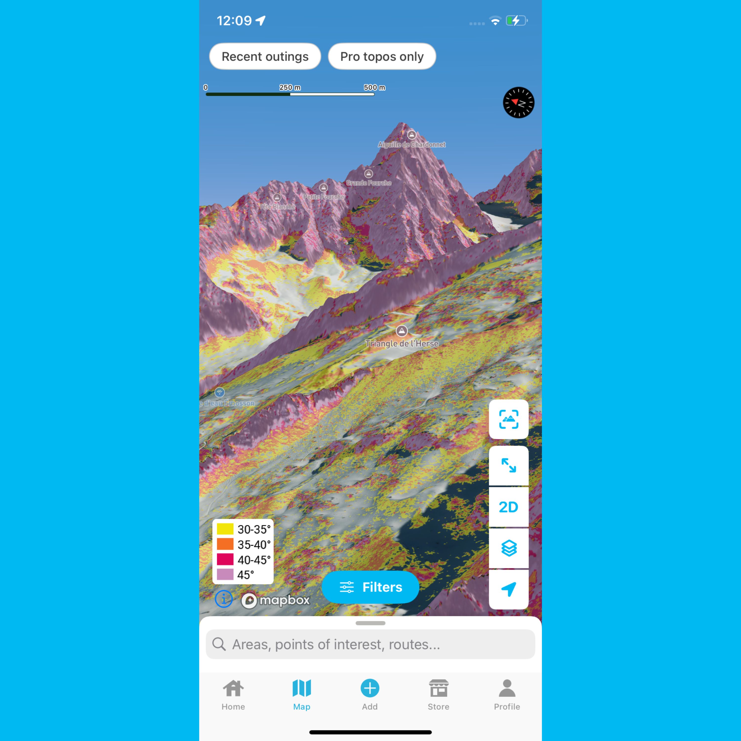
The role of the world model
The world model is designed to provide terrain information on a worldwide scale, especially in regions where detailed or easily accessible national maps don’t exist.
In these cases, having some information -even if less precise locally- is still a useful tool for planning trips, where the alternative is often no data at all.
Greater transparency and upcoming updates
To make it easier to understand the data being used, explicit information has been added in the layer selection menu, showing the resolution for each layer. We believe this level of transparency is important and should become a standard for all outdoor apps.
Additionally, a major update to the world model, which we’ve been working on for several weeks, has been deployed. It now incorporates LiDAR data in part, providing a very high level of accuracy across much of Europe, comparable -and in some cases superior- to national reference DEMs.
A detailed legend of this layer is available here showing resolutions by country.
Whympr remains fully committed to continuous improvement, helping users enjoy mountain sports in a more informed and responsible way.